Grauspitz
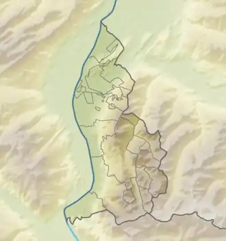
Der Grauspitz ist mit 2599 Metern der höchste Berg des Fürstentums Liechtenstein. Der Doppelgipfel des Grauspitz besteht aus Hintergrauspitz (2574 m), auch Schwarzhorn genannt, und Vordergrauspitz (2599 m). Er gehört zum Gebirge Rätikon und befindet sich auf der Grenze zum Schweizer Kanton Graubünden.
| Vordergrauspitz | ||
|---|---|---|

Vordergrauspitz (links) und Hintergrauspitz (rechts) von Osten. | ||
| Höhe | 2599 m ü. M. | |
| Lage | Liechtenstein / Graubünden, Schweiz | |
| Gebirge | Rätikon | |
| Dominanz | 6,18 km → Schafberg | |
| Schartenhöhe | 353 m ↓ Salarueljoch | |
| Koordinaten | 762782 / 213523 | |
| ||
| Besonderheiten | Höchster Berg Liechtensteins | |

Hintergrauspitz (links) und Vordergrauspitz (rechts) von Nordosten. | ||
Literatur
- Manfred Hunziker: Ringelspitz/Arosa/Rätikon, Alpine Touren/Bündner Alpen, Verlag des SAC 2010, ISBN 978-3-85902-313-0, S. 472 f.
Weblinks
Commons: Grauspitz – Sammlung von Bildern, Videos und Audiodateien
This article is issued from Wikipedia. The text is licensed under Creative Commons - Attribution - Sharealike. The authors of the article are listed here. Additional terms may apply for the media files, click on images to show image meta data.
