Granby (Connecticut)
Granby ist ein Ort im Hartford County im US-Bundesstaat Connecticut, Vereinigte Staaten, mit 11.200 Einwohnern (Stand: 2004). Die geographischen Koordinaten sind: 41,57° Nord, 71,93° West. Das Stadtgebiet hat eine Größe von 105,7 km².
| Granby | |||
|---|---|---|---|
.jpg.webp) | |||
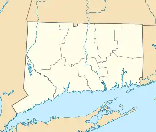
| Lage in Connecticut | |||
| |||
| Basisdaten | |||
| Gründung: | 1723 | ||
| Staat: | Vereinigte Staaten | ||
| Bundesstaat: | Connecticut | ||
| County: | Hartford County | ||
| Koordinaten: | 41° 58′ N, 72° 50′ W | ||
| Zeitzone: | Eastern (UTC−5/−4) | ||
| Einwohner: | 10.903 (Stand: 2020) | ||
| Fläche: | 105,7 km² (ca. 41 mi²) davon 105,4 km² (ca. 41 mi²) Land | ||
| Höhe: | 131 m | ||
| Postleitzahlen: | 06035, 06060, 06090 | ||
| Vorwahl: | +1 860 | ||
| FIPS: | 09-32640 | ||
| GNIS-ID: | 0213434 | ||
| Website: | www.granby-ct.gov | ||
Verkehr
Granby ist ein lokaler Verkehrsknotenpunkt. Es treffen hier die State Route 10, 20, 189 und 219 sowie der U.S. Highway 202 aufeinander. Etwa 10 km entfernt ist die Anbindung an die Interstate 91.
Schulen
- Granby Memorial High School
- Granby Middle School
- Wells Road Elementary School
- Kelly Lane School
- F. M. Kearns Primary School
Weblinks
Commons: Granby (Connecticut) – Sammlung von Bildern, Videos und Audiodateien
- Offizieller Internetauftritt der Stadt Granby (englisch)
This article is issued from Wikipedia. The text is licensed under Creative Commons - Attribution - Sharealike. The authors of the article are listed here. Additional terms may apply for the media files, click on images to show image meta data.