Gaafu Dhaalu
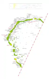
Huvadhu Atholhu Dhekunuburi (Süd-Huvadhu-Atoll), mit der Thaana-Kurzbezeichnung ގދ (Gaafu Dhaalu bzw. Gaafu Dhaal), ist ein Verwaltungsatoll (Distrikt) im Süden der Malediven.
| Huvadhu Atholhu Dhekunuburi (Gaafu Dhaalu) | |
|---|---|
 | |
| Geographie | |
| Staat: | Malediven |
| Gewässer: | Lakkadivensee |
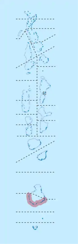
| Inseln: | 147[1] |
| Geographische Lage: | 0° 25′ N, 73° 10′ O |
| Basisdaten | |
| Fläche: | 6,76 km² |
| Einwohner: | 10.991 |
| Bevölkerungsdichte: | 16 Einw./km² |
| Hauptstadt: | Thinadhoo |
| Lagekarte | |
 | |
Es umfasst den südlichen Teil des großen Huvadhu-Atolls. Die Einwohnerzahl beträgt etwa 11.000 (Stand 2006[2]).
Neun Inseln sind bewohnt, neben dem Verwaltungshauptort auf der Insel Thinadhoo (4442 Einwohner) sind dies Faresmaathodaa, Fiyoari, Gadhdhoo, Hoadedhdhoo, Madeveli, Nadallaa, Rathafandhoo und Vaadhoo. Insgesamt umfasst der Distrikt 147[1] Inseln.
Nördlich schließt sich die Provinz Gaafu Alif unmittelbar an, welche den Nordteil des Huvadhu-Atolls umfasst. Etwa 55 km südlich liegt die Provinz Gnaviyani.
Weblinks
Commons: Gaafu Dhaalu – Sammlung von Bildern, Videos und Audiodateien
Einzelnachweise
- The President's Office (Maledives): Isles - Gaafu Dhaalu. In: isles.gov.mv. 2022, abgerufen am 14. Februar 2022.
- Department of National Planning : Statistical YearBook 2011: Table 3.3: POPULATION BY ISLANDS CENSUS 2000, 2006 (Memento vom 4. März 2016 im Internet Archive)
This article is issued from Wikipedia. The text is licensed under Creative Commons - Attribution - Sharealike. The authors of the article are listed here. Additional terms may apply for the media files, click on images to show image meta data.