Forteviot
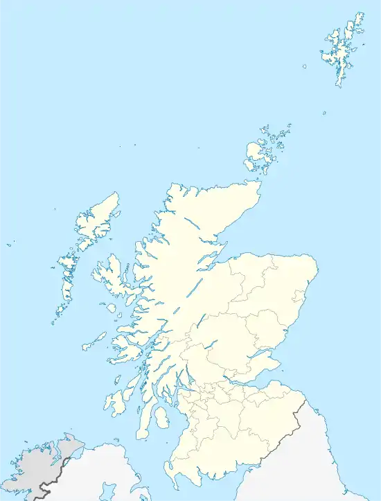
Forteviot, schottisch-gälisch Fothair Tabhaicht,[1] ist eine schottische Ortschaft in der Council Area Perth and Kinross. Sie liegt in der traditionellen Grafschaft Perthshire rund neun Kilometer südwestlich des Zentrums von Perth an der Mündung des Water of May in den Earn.[2][3]
| Forteviot schottisch-gälisch Fothair Tabhaicht | |||
|---|---|---|---|
 Forteviot Square | |||
| Koordinaten | 56° 20′ N, 3° 32′ W | ||
| |||
| Traditionelle Grafschaft | Perthshire | ||
| Verwaltung | |||
| Post town | PERTH | ||
| Postleitzahlenabschnitt | PH2 | ||
| Vorwahl | 01764 | ||
| Landesteil | Schottland | ||
| Council area | Perth and Kinross | ||
| Britisches Parlament | Ochil and South Perthshire | ||
| Schottisches Parlament | Perthshire South and Kinross-shire | ||
Geschichte
Forteviot war Hauptort des piktischen Königreichs Fortriu. Der Gründungslegende von St Andrews zufolge, errichtete König Óengus I. († 761) am Standort eine Kirche. Kenneth MacAlpin soll hier im Jahre 860 in seinem Palast verstorben sein. Auf einem Hügel oberhalb der Ortschaft befand sich die Burg Malcolm Canmores. Edward Balliols Armee kampierte 1332 vor der Schlacht von Dupplin Moor, eine der entscheidenden Schlachten des Zweiten Schottischen Unabhängigkeitskriegs, auf einem Feld unterhalb der Burg.[2][3]
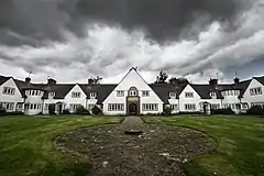
Das nahegelegene Herrenhaus Invermay House geht auf ein Tower House aus dem 16. Jahrhundert zurück.[4] John Dewar, 1. Baron Forteviot, Erbe des Whiskykonzerns Dewar’s, ließ Forteviot in den 1920er Jahren neu aufbauen.[2] In diesem Zuge entstanden die Forteviot Hall[5] und der Forteviot Square[6]
Bei Zensuserhebung 1991 zählte Forteviot 160 Einwohner.[7]
Verkehr
Die Ortschaft ist über untergeordnete Straßen angeschlossen. Nördlich ist die A9 in kurzer Distanz zugänglich.[8] 1848 eröffnete die Scottish Central Railway einen Bahnhof in Forteviot. Während die Strecke weiterhin genutzt wird, wurde der Bahnhof 1856 aufgelassen.[9]
Einzelnachweise
- Informationen des schottischen Parlaments
- Eintrag im Gazetteer for Scotland
- Forteviot in: F. H. Groome (Hrsg.): Ordnance Gazetteer of Scotland: A Survey of Scottish Topography, Statistical, Biographical and Historical, Grange Publishing Works, Edinburgh, 1882–1885.
- Listed Building – Eintrag. In: Historic Scotland.
- Listed Building – Eintrag. In: Historic Scotland.
- Listed Building – Eintrag. In: Historic Scotland.
- Informationen im Gazetteer for Scotland
- Karte der Ordnance Survey
- Informationen auf railscot.co.uk