Fara (Insel)
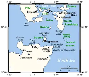
Die Insel Fara (Foerey – „Schafsinsel“) gehört zum Archipel der Orkney etwa 30 km nördlich von Schottland. Im Archipel liegt sie zwischen den Inseln Hoy und Flotta in der Bucht von Scapa Flow. Die Insel ist 295 ha groß und seit 1947 unbewohnt.
| Fara | |
|---|---|
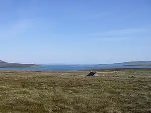 Verlassenes Haus auf Fara | |
| Gewässer | Nordsee |
| Inselgruppe | Orkney-Inseln |
| Geographische Lage | 58° 50′ 41″ N, 3° 9′ 58″ W |
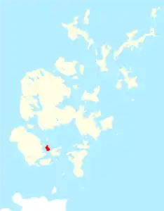 Lage von Fara | |
| Fläche | 2,95 km² |
| Einwohner | unbewohnt |
Im Zweiten Weltkrieg stiegen von hier Sperrballons auf.
Das Wind-Energieprojekt von 2010 sieht den Bau von Wind-Turbinen auf Fara vor.
Literatur
- Charles Tait: The Orkney Guide Book. Edition 2.1. C. Tait, Kelton – St. Ola – Orkney 1999, ISBN 0-9517859-0-7, S. 167.
- John R. Hunter, Stephen J. Dockrill, Jacqueline I. McKinley: The Sites and Monuments of Fara, Orkney (= Bradford University School of Archaeological Sciences Occasional Papers. Nr. 1). School of Archaeological Sciences – University of Bradford, Bradford 1982.
Auskerry | Burray | Calf of Eday | Cava | Copinsay | Damsay | Eday | Egilsay | Eynhallow | Fara | Faray | Flotta | Gairsay | Graemsay | Holm of Grimbister | Holm of Huip | Holm of Papa | Hoy | Lamb Holm | Linga Holm | Mainland | Muckle Skerry | North Ronaldsay | Papa Stronsay | Papa Westray | Rousay | Rysa Little | Sanday | Shapinsay | South Ronaldsay | Stronsay | Sule Skerry | Sule Stack | Switha | Swona | Westray | Wyre