Dauin
Dauin ist eine philippinische Gemeinde in der Provinz Negros Oriental. Sie hat 27.786 Einwohner (Zensus 1. August 2015).
| Municipality of Dauin | |||
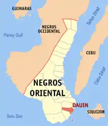
| Lage von Dauin in der Provinz Negros Oriental | |||
|---|---|---|---|
 | |||
| Basisdaten | |||
| Region: | Central Visayas | ||
| Provinz: | Negros Oriental | ||
| Barangays: | 23 | ||
| Distrikt: | 3. Distrikt von Negros Oriental | ||
| PSGC: | 074609000 | ||
| Einkommensklasse: | 4. Einkommensklasse | ||
| Haushalte: | 4464 Zensus 1. Mai 2000 | ||
| Einwohnerzahl: | 27.786 Zensus 1. August 2015 | ||
| Koordinaten: | 9° 11′ N, 123° 16′ O | ||
| Postleitzahl: | 6217 | ||
| Bürgermeister: | Rodrigo A. Alanano | ||
| Geographische Lage auf den Philippinen | |||
| |||

Die Gemeinde Dauin grenzt im Norden an Bacong, im Süden an Zamboanguita. Im Westen bildet eine Bergkette die Grenze zu Santa Catalina. Dauin liegt an der Ostküste der Insel Negros.
Zur Gemeinde gehört auch die Insel Apo, die ein beliebter Platz für Sporttaucher ist. Apo ist mit dem Boot vom Festland in etwa 30 Minuten zu erreichen.
Baranggays
Dauin ist politisch in 23 Barangays unterteilt.
|
|
This article is issued from Wikipedia. The text is licensed under Creative Commons - Attribution - Sharealike. The authors of the article are listed here. Additional terms may apply for the media files, click on images to show image meta data.