Claremont (Ontario)
Claremont ist eine Ortsgemeinde nördlich von Pickering und südlich von Uxbridge westlich der Brock Road und östlich der Eisenbahnstrecke CNCP. Sie liegt etwa 40 km nordöstlich von Toronto.
- Einwohner: etwa 2.779
- Höhe über NN: etwa 200 m
- Telefonvorwahl: (00)1-905
| Claremont | |||
|---|---|---|---|
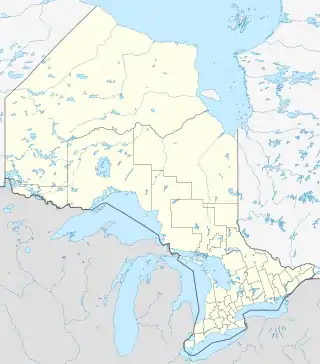
| Lage in Ontario | |||
| |||
| Staat: | |||
| Provinz: | Ontario | ||
| County: | Regional Municipality of Durham | ||
| Koordinaten: | 43° 58′ N, 79° 8′ W | ||
| Höhe: | 200 m | ||
| Fläche: | 5 km² | ||
| Einwohner: | 2779 (Stand: 2006) | ||
| Bevölkerungsdichte: | 555,8 Einw./km² | ||
| Postleitzahl: | L1S, L1T, L1Z, L1Y | ||
| Gründung: | 1840 | ||
| Website: | www.claremontcommunity.ca | ||
Die Fläche der Gemeinde ist zu etwa zwei Dritteln mit Wald bedeckt und zu einem Drittel bebaut bzw. bewirtschaftet. Nachbargemeinden sind Markham im Westen, Uxbridge im Norden, Brooklin im Osten, sowie Greenwood und Pickering im Süden.
This article is issued from Wikipedia. The text is licensed under Creative Commons - Attribution - Sharealike. The authors of the article are listed here. Additional terms may apply for the media files, click on images to show image meta data.
