Clare and Gilbert Valleys Council
Der District Council of Clare and Gilbert Valleys ist ein lokales Verwaltungsgebiet (LGA) im australischen Bundesstaat South Australia. Das Gebiet ist 1.840 km² groß und hat etwa 9000 Einwohner (2016).
| District Council of Clare and Gilbert Valleys | |
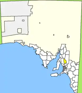 Lage des Clare and Gilbert Valleys Council in South Australia | |
| Gliederung | |
| Staat: | |
| Bundesstaat: | |
| Verwaltungssitz: | Clare |
| Daten und Zahlen | |
| Fläche: | 1.840 km² |
| Einwohner: | 9.023 (2016) [1] |
| Bevölkerungsdichte: | 4,9 Einwohner je km² |
Die Clare and Gilbert Valleys gehören zur Lower-North-Region von South Australia und liegen etwa 120 Kilometer nördlich der Metropole Adelaide. Das Gebiet beinhaltet 49 Ortsteile und Ortschaften:
|
|
|
|
|
|
Verwaltung
Der Verwaltungssitz des Councils befindet sich in der Ortschaft Clare im Nordwesten der LGA, wo etwa 3300 Einwohner leben (2016).[2] Der Council von Clare und Gilbert Valleys hat zehn Mitglieder, die neun Councillor und der Vorsitzende und Mayor (Bürgermeister) des Councils werden von den Bewohnern der LGA gewählt. Clare und Gilbert Valleys ist nicht in Bezirke untergliedert.
Einzelnachweise
- Australian Bureau of Statistics: Clare and Gilbert Valleys (DC) (Local Government Area) (Englisch) In: 2016 Census QuickStats. 27. Juni 2017. Abgerufen am 20. April 2020.
- Australian Bureau of Statistics: Clare (Urban Centre/Locality) (Englisch) In: 2016 Census QuickStats. 27. Juni 2017. Abgerufen am 20. April 2020.