Ashfield Municipality
Die Municipality of Ashfield war ein lokales Verwaltungsgebiet (LGA) im australischen Bundesstaat New South Wales. Ashfield gehörte zur Metropole Sydney, der Hauptstadt von New South Wales. Das Gebiet ist 8 km² groß und hatte zuletzt etwa 41.000 Einwohner.[1]
| Municipality of Ashfield | |
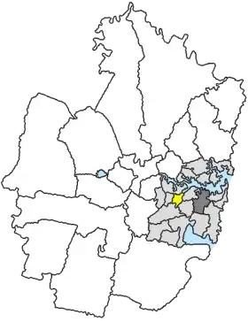 Lage der Ashfield Municipality in Sydney | |
| Gliederung | |
| Staat: | |
| Bundesstaat: | |
| Verwaltungssitz: | Ashfield |
| Daten und Zahlen | |
| Fläche: | 8 km² |
| Einwohner: | 41.214 (2011) [1] |
| Bevölkerungsdichte: | 5152 Einwohner je km² |
| Wards: | 4 |
Ashfield lag etwa 8 km westlich des Stadtzentrums von Sydney südlich des Hafens. Das Gebiet beinhaltet 12 Stadtteile: Ashfield North, Dobroyd Point, Haberfield, Summer Hill und Teile von Ashbury, Ashfield, Ashfield South, Canterbury, Croydon, Croydon North, Croydon Park und Hurlstone Park. Der Sitz des Municipality Councils befindet sich im Stadtteil Ashfield in der Südhälfte der LGA.
2016 ging das Verwaltungsgebiet im Inner West Council auf.[2]
Verwaltung
Der Council of the Municipality of Ashfield hat zwölf Mitglieder, die von den Bewohnern der vier Wards gewählt werden (je drei Councillor aus North, North East, East und South Ward). Diese vier Bezirke sind unabhängig von den Stadtteilen festgelegt. Aus dem Kreis der Councillor rekrutiert sich auch der Mayor (Bürgermeister) des Councils.
Weblinks
Einzelnachweise
- Australian Bureau of Statistics: Ashfield (A) (Local Government Area) (Englisch) In: 2011 Census QuickStats. 28. März 2013. Abgerufen am 10. April 2014.
- Governor of New South Wales (Hrsg.): Local Government (Council Amalgamations) Proclamation 2016. (gov.au [PDF]).