Armação de Pêra
Armação de Pêra ist eine portugiesische Gemeinde im Kreis Silves mit 8,0 km² Fläche und 4867 Einwohnern (Stand 30. Juni 2011). Die Bevölkerungsdichte beträgt 609 Einwohner/km².
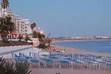
Praia de Armação de Pêra
| Armação de Pêra | ||||||
|---|---|---|---|---|---|---|
| ||||||
| Basisdaten | ||||||
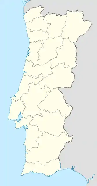
| Region: | Algarve | |||||
| Unterregion: | Algarve | |||||
| Distrikt: | Faro | |||||
| Concelho: | Silves | |||||
| Koordinaten: | 37° 8′ N, 8° 22′ W | |||||
| Einwohner: | 4867 (Stand: 30. Juni 2011)[1] | |||||
| Fläche: | 7,99 km² (Stand: 1. Januar 2010)[2] | |||||
| Bevölkerungsdichte: | 609 Einwohner pro km² | |||||
Armação de Pêra ist ein ehemaliges Fischerdorf und heute ein beliebter Badeort an der Algarveküste. Das Ortsbild wird vom Tourismus geprägt. Hierbei fallen vor allem die zahlreichen Appartementblöcke und Hochhäuser aus den 1970er Jahren ins Auge.
Sehenswürdigkeiten
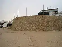
Fortaleza de Armação de Pera
Am Strand befindet sich eine kleine Festung, die Fortaleza de Armação de Pera aus dem Jahr 1571. Hierzu gehört auch die kleine Capela de Santo António von 1720.
Strände
- Praia de Armação de Pêra
- Praia da Senhora da Rocha
- Praia Grande
- Praia dos Salgados
Einzelnachweise
- www.ine.pt – Indikator Resident population by Place of residence and Sex; Decennial in der Datenbank des Instituto Nacional de Estatística
- Übersicht über Code-Zuordnungen von Freguesias auf epp.eurostat.ec.europa.eu
Weblinks
- Karte der Freguesia Armação de Pêra beim Instituto Geográfico do Exército
Freguesias im Concelho Silves
Alcantarilha e Pêra | Algoz e Tunes | Armação de Pêra | São Bartolomeu de Messines | São Marcos da Serra | Silves
This article is issued from Wikipedia. The text is licensed under Creative Commons - Attribution - Sharealike. The authors of the article are listed here. Additional terms may apply for the media files, click on images to show image meta data.