Anchor Islands
Die Anchor Islands[1] sind eine unbewohnte Inselgruppe in der Great Barrier Reef World Heritage Area im Korallenmeer. Die Inseln zählen zur Gruppe der Cumberland Islands des australischen Bundesstaats Queensland.
| Anchor Islands | ||
|---|---|---|
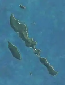 Satellitenbild der Inselgruppe | ||
| Gewässer | Korallenmeer | |
| Archipel | Cumberland Islands | |
| Geographische Lage | 20° 39′ S, 149° 4′ O | |
| ||
| Anzahl der Inseln | 7 | |
| Hauptinsel | Blacksmith Island | |
| Gesamte Landfläche | 3,5 km² | |
| Einwohner | unbewohnt | |
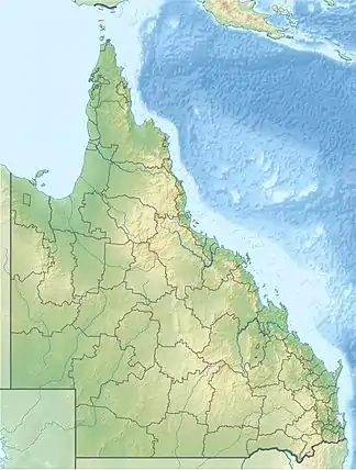
Die Inselgruppe liegt im Westen der Cumberland Islands, rund 30 Kilometer vor der Küste des ostaustralischen Festlands. Etwa sieben Kilometer nordöstlich befinden sich die Lindeman Islands, knapp fünf Kilometer südöstlich die Sir James Smith Islands.
Mit einer Fläche von rund zwei Quadratkilometern ist die langgestreckte Blacksmith Island die größte Insel der Gruppe.
Inseln
![]() Karte mit allen Koordinaten: OSM | WikiMap
Karte mit allen Koordinaten: OSM | WikiMap
Zu den Anchor Islands gehören folgende Inseln:
| Inselname | Aliasname | Koordinaten | Fläche |
|---|---|---|---|
| Anchorsmith Island | 20° 37′ S, 149° 04′ O | 0,01 | |
| Anvil Island | 20° 38′ S, 149° 04′ O | 0,01 | |
| Blacksmith Island | 20° 38′ S, 149° 04′ O | 2,00 | |
| Hammer Island | 20° 39′ S, 149° 03′ O | 0,68 | |
| Ladysmith Island | 20° 39′ S, 149° 05′ O | 0,71 | |
| Bellows Island | 20° 40′ S, 149° 04′ O | 0,02 | |
| Pincer Island | 20° 41′ S, 149° 06′ O | 0,03 |
This article is issued from Wikipedia. The text is licensed under Creative Commons - Attribution - Sharealike. The authors of the article are listed here. Additional terms may apply for the media files, click on images to show image meta data.