Zia Pueblo
Zia Pueblo (Östliches Keres: Tsi'ya, Spanisch: Pueblo de Zía) ist die Hauptsiedlung des Pueblo-Volks der Zia (Tsʾíiyʾamʾé) im Sandoval County im US-Bundesstaat New Mexico.
| Zia Pueblo | |
|---|---|
 Flagge | |
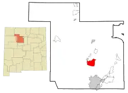
| Lage in New Mexico | |
 | |
| Basisdaten | |
| Staat: | Vereinigte Staaten |
| Bundesstaat: | New Mexico |
| County: | Sandoval County |
| Koordinaten: | 35° 31′ N, 106° 43′ W |
| Zeitzone: | Mountain (UTC−7/−6) |
| Einwohner: | 646 (Stand: 2000) |
| Fläche: | 70,8 km² (ca. 27 mi²) davon 70,7 km² (ca. 27 mi²) Land |
| Höhe: | 1668 m |
| Postleitzahl: | 87053 |
| Vorwahl: | +1 505 |
| FIPS: | 35-86420 |
| GNIS-ID: | 0928840 |
| Website: | www.ziapueblo.org |
Sie hat 646 Einwohner auf einer Fläche von 70,8 km². Die Bevölkerungsdichte liegt somit bei 9,1 pro km². Die Stadt liegt ganz in der Zia-Reservation, etwa 60 Kilometer nördlich von der Stadt Albuquerque.
Weblinks
Commons: Zia Pueblo – Sammlung von Bildern, Videos und Audiodateien
This article is issued from Wikipedia. The text is licensed under Creative Commons - Attribution - Sharealike. The authors of the article are listed here. Additional terms may apply for the media files, click on images to show image meta data.