Verwaltungsregionen der Stadt Rio de Janeiro
Rio de Janeiro gliedert sich in 33 Verwaltungsregionen (Regiões Administrativas). Diese sind 8 Unterpräfekturen und statistisch 5 Planungsgebieten (Áreas de Planejamento) zugeordnet. Die Verwaltungsregionen unterteilen sich in 161 Stadtviertel (Bairros).
- Área de Planejamento 1: Centro, Paquetá, Portuária, Rio Comprido, Santa Teresa, São Cristóvão
- Área de Planejamento 2: Botafogo, Copacabana, Lagoa, Rocinha, Tijuca, Vila Isabel
- Área de Planejamento 3: Anchieta, Complexo do Alemão, Ilha do Governador, Inhaúma, Irajá, Jacarezinho, Madureira, Maré, Méier, Pavuna, Penha, Ramos, Vigário Geral
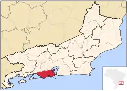
- Área de Planejamento 4: Barra da Tijuca, Cidade de Deus, Jacarepaguá
- Área de Planejamento 5: Bangu, Campo Grande, Guaratiba, Realengo, Santa Cruz
Einwohnerzahlen
Die Einwohnerzahlen in der folgenden Tabelle beziehen sich auf die Volkszählung vom 1. August 2000[1]
| Verwaltungsregionen von Rio de Janeiro | |||||
| Name | Fläche in km² | Einwohnerzahl | Einwohner je km² | ||
| Anchieta | 14,19 | 154.608 | 10.896 | ||
| Bangu | 67,81 | 420.503 | 6.201 | ||
| Barra da Tijuca | 165,97 | 174.353 | 1.051 | ||
| Botafogo | 15,03 | 238.895 | 15.895 | ||
| Campo Grande | 153,44 | 484.362 | 3.157 | ||
| Centro | 5,72 | 39.135 | 6.842 | ||
| Cidade de Deus | 1,21 | 38.016 | 31.418 | ||
| Complexo do Alemão | 2,96 | 65.026 | 21.968 | ||
| Copacabana | 5,08 | 161.178 | 31.728 | ||
| Guaratiba | 152,58 | 101.205 | 663 | ||
| Ilha do Governador | 41,45 | 211.469 | 5.102 | ||
| Inhaúma | 10,88 | 130.635 | 12.007 | ||
| Irajá | 15,04 | 202.967 | 13.495 | ||
| Jacarepaguá | 126,61 | 469.682 | 3.710 | ||
| Jacarezinho | 0,94 | 36.459 | 38.786 | ||
| Lagoa | 23,73 | 174.062 | 7.335 | ||
| Madureira | 30,18 | 374.157 | 12.398 | ||
| Maré | 4,27 | 113.807 | 26.653 | ||
| Méier | 29,41 | 398.486 | 13.549 | ||
| Paquetá | 1,71 | 3.421 | 2.001 | ||
| Pavuna | 17,48 | 197.068 | 11.274 | ||
| Penha | 13,96 | 183.194 | 13.123 | ||
| Portuária | 8,51 | 39.973 | 4.697 | ||
| Ramos | 88 | 150.403 | 13.310 | ||
| Realengo | 54,55 | 239.146 | 4.384 | ||
| Rio Comprido | 5,80 | 73.661 | 12.700 | ||
| Rocinha | 1,44 | 56.338 | 39.124 | ||
| Santa Cruz | 164,08 | 311.289 | 1.897 | ||
| Santa Teresa | 5,16 | 41.145 | 7.974 | ||
| São Cristóvão | 7,50 | 70.945 | 9.459 | ||
| Tijuca | 42,28 | 180.992 | 4.281 | ||
| Vigário Geral | 11,41 | 135.311 | 11.859 | ||
| Vila Isabel | 12,88 | 186.013 | 14.442 | ||
| Rio de Janeiro | 1.224,56 | 5.857.904 | 4.784 | ||
Einzelnachweise
- nach Instituto Brasileiro de Geografia e Estatística
Weblinks
- Karte der Áreas de Planejamento (Stand: 2004)
- Karte der Regiões Administrativas (Stand: 2004)
- Karte der Bairros (Stand: 2004)
| Centro e Centro Histórico |
Bairro de Fátima | Catumbi | Centro | Cidade Nova | Estácio | Gamboa | Mangueira | Paquetá | Praça XV | Praça Mauá | Santo Cristo | São Cristóvão | Saúde |
|
| Zona Sul |
Bairro Peixoto | Botafogo | Catete | Copacabana | Cosme Velho | Flamengo | Gávea | Glória | Humaitá | Ipanema | Jardim Botânico | Lagoa | Laranjeiras | Leblon | Leme | Rocinha | Santa Teresa | São Conrado | Urca | Vidigal | |
| Zona Norte 1 |
Abolição | Acari | Água Santa | Anchieta | Barros Filho | Benfica | Bento Ribeiro | Brás de Pina | Cachambi | Caju | Campinho | Cascadura | Cavalcante | Cidade Universitária | Coelho Neto | Colégio | Cordovil | Costa Barros | Encantado | Engenheiro Leal | Engenho da Rainha | Engenho de Dentro | Engenho Novo | Guadalupe | Honório Gurgel | Irajá | Jacaré | Jardim América | Lins de Vasconcelos | Madureira | Marechal Hermes | Maria da Graça | Oswaldo Cruz | Parada de Lucas | Parque Anchieta | Parque Colúmbia | Pavuna | Penha | Penha Circular | Pilares | Quintino Bocaiúva | Riachuelo | Ricardo de Albuquerque | Rio Comprido | Rocha | Rocha Miranda | Sampaio | São Francisco Xavier | Todos os Santos | Turiaçu | Vasco da Gama | Vaz Lobo | Vicente de Carvalho | Vigário Geral | Vila Cosmos | Vila da Penha | Vista Alegre | |
| Zona Norte 2 |
Complexo do Alemão | Del Castilho | Higienópolis | Inhaúma | Jacarezinho | Manguinhos | Méier | Piedade | Tomás Coelho | | |
| Zona Norte 3 (Ilha do Governador) |
Bancários | Bonsucesso | Cacuia | Cocotá | Freguesia da Ilha | Fundão | Galeão | Ilha do Governador | Jardim Carioca | Jardim Guanabara | Maré | Moneró | Olaria | Paquetá | Pitangueiras | Portuguesa | Praia da Bandeira | Ramos | Ribeira | Tauá | Tubiacanga | Zumbi | |
| Zona Oeste |
Bangu | Barra de Guaratiba | Campo dos Afonsos | Campo Grande | Cosmos | Deodoro | Gericinó | Guaratiba | Inhoaíba | Magalhães Bastos | Paciência (Rio de Janeiro) | Padre Miguel | Pedra de Guaratiba | Realengo | Santa Cruz | Santíssimo | Senador Camará | Senador Vasconcelos | Sepetiba | Vargem Grande | Vargem Pequena | Vila Militar | |
| Barra e Jacarepaguá |
Barra da Tijuca | Anil (Rio de Janeiro) | Camorim | Cidade de Deus | Curicica | Freguesia | Gardênia Azul | Grumari | Itanhangá | Jacarepaguá | Jardim Sulacap | Joá | Pechincha | Praça Seca | Recreio | Taquara | Tanque | Vila Valqueire | |
| Tijuca e Adjacências |
Alto da Boa Vista | Andaraí | Grajaú | Maracanã | Praça da Bandeira | Vila Isabel | Tijuca | |

%20-%202004.JPG)