Tucson Estates
Tucson Estates ist ein Census-designated place im Pima County im US-Bundesstaat Arizona. Sie hat 9755 Einwohner auf einer Fläche von 90,9 km². Die Bevölkerungsdichte liegt bei 107,3/km². Die Koordinaten sind 32°10'51" Nord, 111°6'35" West. Die Stadt liegt in der Nähe des Saguaro National Park-West und des Ironwood Forest National Park. Sie wird von der Arizona State Route 86 tangiert.
| Tucson Estates | |
|---|---|
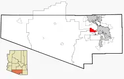 Lage im County und in Arizona | |
| Basisdaten | |
| Staat: | Vereinigte Staaten |
| Bundesstaat: | Arizona |
| County: | Pima County |
| Koordinaten: | 32° 11′ N, 111° 7′ W |
| Zeitzone: | Mountain Standard Time (UTC−7) |
| Einwohner: | 12.069 (Stand: 2020) |
| Fläche: | 90,9 km² (ca. 35 mi²) davon 90,9 km² (ca. 35 mi²) Land |
| Höhe: | 807 m |
| FIPS: | 04-77035 |
| GNIS-ID: | 0025245 |
This article is issued from Wikipedia. The text is licensed under Creative Commons - Attribution - Sharealike. The authors of the article are listed here. Additional terms may apply for the media files, click on images to show image meta data.