Tsamblak Hill
Der Tsamblak Hill (englisch; bulgarisch хълм Цамблак chalm Zamblak) ist ein 113 m hoher und felsiger Hügel im Osten der Byers-Halbinsel auf der Livingston-Insel im Archipel der Südlichen Shetlandinseln. Er erstreckt sich 1,73 km nördlich des Negro Hill, 4,23 km östlich des Chester Cone und 1,45 km südlich des Sparadok Point über eine Länge von 900 m in nord-südlicher Ausrichtung.
| Tsamblak Hill | ||
|---|---|---|
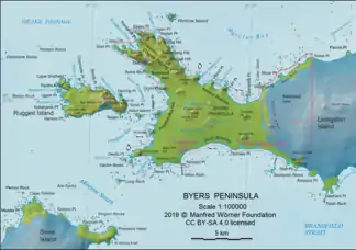
Karte der Byers-Halbinsel mit dem Tsamblak Hill | ||
| Höhe | 113 m | |
| Lage | Livingston-Insel, Südliche Shetlandinseln | |
| Koordinaten | 62° 38′ 21″ S, 61° 0′ 12″ W | |
| ||

Spanische Wissenschaftler kartierten ihn 1992, bulgarische 2009. Die bulgarische Kommission für Antarktische Geographische Namen benannte ihn 2006 nach Grigorij Camblak (1365–1420), bulgarischer Gelehrter und Metropolit von Kiew.
Weblinks
- Tsamblak Hill im Composite Gazetteer of Antarctica (englisch)
This article is issued from Wikipedia. The text is licensed under Creative Commons - Attribution - Sharealike. The authors of the article are listed here. Additional terms may apply for the media files, click on images to show image meta data.