Kommission für Antarktische Geographische Namen
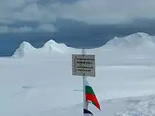
Die Kommission für Antarktische Geographische Namen (bulgarisch Komisija po antarktitscheskite naimenowanija Комисия по антарктическите наименования) ist eine bulgarische Kommission zur Empfehlung von Namen für Teile der Antarktis. Die Kommission wurde vom Bulgarischen Antarktis-Institut 1994 gegründet, sie untersteht seit 2001 dem bulgarischen Außenministerium.
2018 gab es 19.788 geographische Namen in der Antarktis, einschließlich der 1.433 Namen, die durch Bulgarien vergeben wurden.[1] Beschreibungen der bulgarischen antarktischen Namen werden im internationalen toponymischen Lexikon der Antarktis (englisch Composite Gazetteer of Antarctica) veröffentlicht, das vom internationalen Wissenschaftlichen Komitee für Antarktisforschung geführt wird.
Die Kommission bereitete die erste bulgarische topografische Karte der Livingston-Insel vor und veröffentlichte diese 2005.
Karten
- St. Kliment Ohridski Base, Livingston Island. Scale 1:1.000 topographic map. Sofia: Antarctic Place-names Commission of Bulgaria, 1996. (bulgarisch)
- Antarctica: Livingston Island. Scale 1:100.000 topographic map. Sofia: Antarctic Place-names Commission, 2005. (englisch)
- Antarctica: Livingston Island and Greenwich, Robert, Snow and Smith Islands. Scale 1:120.000 topographic map made by the Military Geographic Service and the Antarctic Place-names Commission. Troyan: Manfred Wörner Foundation, 2009. (englisch) (bulgarische Version)
- Antarctica: Livingston Island and Smith Island. Scale 1:100000 topographic map. Manfred Wörner Foundation, 2017. (englisch)
Weblinks
- Bulgarische Antarctic Place-names Commission of Bulgaria (englisch)
- SCAR Composite Gazetteer of Antarctica: Naming Authorities. (englisch)
- Antarctic Digital Database (ADD). Scale 1:250.000 topographic map of Antarctica with place-name search. Scientific Committee on Antarctic Research (SCAR). Since 1993, regularly upgraded and updated.
- Toponymic Guidelines for Antarctica. Antarctic Place-names Commission, 1995. (englischsprachige Wikisource)
Einzelnachweise
- SCAR Composite Gazetteer of Antarctica: Home. (englisch)