Tatopani (Sindhupalchok)
Tatopani (Nepali तातोपानी) ist ein Dorf und ein Village Development Committee (VDC) in Nepal im Distrikt Sindhupalchok.
| Tatopani तातोपानी | |||
|---|---|---|---|
| |||
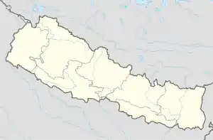
| Koordinaten | 27° 57′ N, 85° 57′ O | ||
| Basisdaten | |||
| Staat | Nepal | ||
| Bagmati | |||
| Distrikt | Sindhupalchok | ||
| Höhe | 1900 m | ||
| Einwohner | 6774 (2011) | ||
 Araniko Rajmarg bei Kodari Araniko Rajmarg bei Kodari | |||
Das VDC Tatopani liegt im Himalaya im Norden von Sindhupalchok an der Grenze zu Tibet. Die Fernstraße Araniko Rajmarg führt entlang dem Sunkoshi (auch Bhotekoshi) durch das Gebiet und endet bei Kodari an der Brücke der sino-nepalesischen Freundschaft.
Einwohner
Bei der Volkszählung 2011 hatte das VDC Tatopani 6774 Einwohner (davon 3512 männlich) in 1733 Haushalten.[1]
Dörfer und Hamlets
Tatopani besteht aus mehreren Dörfern und Hamlets.[2] Die wichtigsten sind:
![]() Karte mit allen Koordinaten des Abschnitts Dörfer und Hamlets: OSM
Karte mit allen Koordinaten des Abschnitts Dörfer und Hamlets: OSM
Weblinks
Commons: Tatopani – Sammlung von Bildern, Videos und Audiodateien
Einzelnachweise
- National Population and Housing Census 2011 (PDF) Central Bureau of Statistics. Archiviert vom Original am 31. Juli 2013.
- District: Sindhupalchok. List of Settlements (PDF) In: Index of Geographical names of Nepal. National Geographic Information Infrastructure Programme. www.ngiip.gov.np. Archiviert vom Original am 9. März 2016. Abgerufen am 16. September 2015.
This article is issued from Wikipedia. The text is licensed under Creative Commons - Attribution - Sharealike. The authors of the article are listed here. Additional terms may apply for the media files, click on images to show image meta data.