Storkerson Peninsula
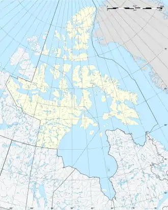
Storkerson Peninsula ist eine Halbinsel der Victoria-Insel im kanadischen Territorium Nunavut. Sie trennt den McClintock-Kanal von der Hadley Bay.[1]
| Storkerson Peninsula | ||
| Geographische Lage | ||
| ||
| Koordinaten | 72° 30′ N, 106° 30′ W | |
| Gewässer 1 | Hadley Bay | |
| Gewässer 2 | McClintock-Kanal | |
| Länge | 220 km | |
| Breite | 94 km | |
Storkerson Peninsula ist etwa 220 Kilometer lang und bis zu 94 Kilometer breit. Sie ist benannt nach Størker Størkersen, der in Kanada Storker Storkerson hieß,[2] einem norwegischen Teilnehmer an mehreren Arktisexpeditionen, der im Winter 1915/16 die Nordostküste der Victoria-Insel kartierte.[3]
Einzelnachweise
- Storkerson Peninsula, Natural Resources Canada, abgerufen am 12. Februar 2018 (englisch).
- Størker Størkersen auf der Website Norsk Polarhistorie, abgerufen am 22. Februar 2018 (norwegisch).
- William James Mills: Exploring Polar Frontiers – A Historical Encyclopedia. Band 2. ABC-CLIO, 2003, ISBN 1-57607-422-6, S. 678–680 (englisch, eingeschränkte Vorschau in der Google-Buchsuche).
This article is issued from Wikipedia. The text is licensed under Creative Commons - Attribution - Sharealike. The authors of the article are listed here. Additional terms may apply for the media files, click on images to show image meta data.
