Soda Lake (Washington)
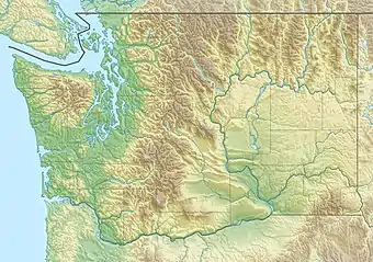
Der Soda Lake ist ein staugeregelter See in Grant County, Washington, Vereinigte Staaten.
| Soda Lake | ||
|---|---|---|
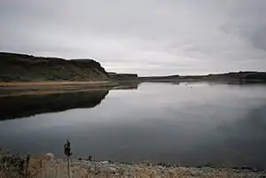 | ||
| Blick vom Staudamm des Sees auf den See | ||
| Geographische Lage | Grant County, Washington, USA | |
| Zuflüsse | Potholes Canal vom Potholes Reservoir | |
| Abfluss | Potholes East Canal zum Scooteney Reservoir | |
| Ufernaher Ort | Warden | |
| Daten | ||
| Koordinaten | 46° 57′ 47″ N, 119° 14′ 18″ W | |
| ||
| Höhe über Meeresspiegel | 305 m[1] | |
| Fläche | 62 ha (154,10 Acres[2]) | |
Er ist der erste (oberste) und mit 62 Hektar (154,1 Acres[2]) größte See im Lauf des Bewässerungskanals Potholes Canal, der als Teil des Columbia Basin Project die Stauseen Potholes Reservoir und Scootenay Reservoir verbindet.
Im See leben Schwarzflecken- und Blauer Sonnenbarsch, Karpfen, Forellenbarsch, Regenbogenforelle, Schwarz- und Glasaugenbarsch sowie Amerikanischer Flussbarsch.[2]
Weblinks
Commons: Soda Lake (Washington) – Sammlung von Bildern, Videos und Audiodateien
Einzelnachweise
- Soda Lake (Washington) im Geographic Names Information System des United States Geological Survey, abgerufen am 23. November 2020
- Soda Lake | Washington Department of Fish & Wildlife. Abgerufen am 29. November 2020
This article is issued from Wikipedia. The text is licensed under Creative Commons - Attribution - Sharealike. The authors of the article are listed here. Additional terms may apply for the media files, click on images to show image meta data.