Sierra Vista Southeast
Sierra Vista Southeast ist ein Census-designated place im US-Bundesstaat Arizona im Cochise County. Das Gebiet hat auf einer Fläche von 290,8 km² etwa 12.500 Einwohner (Stand 2004) und wird von der Arizona State Route 92 tangiert.
| Sierra Vista Southeast | |
|---|---|
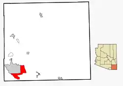 Lage im County und in Arizona | |
| Basisdaten | |
| Staat: | Vereinigte Staaten |
| Bundesstaat: | Arizona |
| County: | Cochise County |
| Koordinaten: | 31° 28′ N, 110° 14′ W |
| Zeitzone: | Mountain Standard Time (UTC−7) |
| Einwohner: | 14.428 (Stand: 2020) |
| Fläche: | 290,8 km² (ca. 112 mi²) davon 290,8 km² (ca. 112 mi²) Land |
| FIPS: | 04-66845 |
| GNIS-ID: | 2408736 |
Im Jahr 2010 hatte Sierra Vista Southeast 14.767 Einwohner.
Weblinks
Commons: Sierra Vista Southeast – Sammlung von Bildern, Videos und Audiodateien
This article is issued from Wikipedia. The text is licensed under Creative Commons - Attribution - Sharealike. The authors of the article are listed here. Additional terms may apply for the media files, click on images to show image meta data.