Shackleton Gap
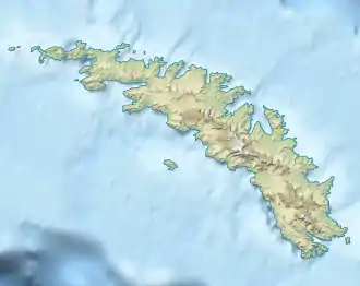
Shackleton Gap ist ein vereister Gebirgspass auf Südgeorgien. Er verläuft in etwa 300 m Höhe zwischen der King Haakon Bay und der Possession Bay.
| Shackleton Gap | |||
|---|---|---|---|
| Himmelsrichtung | Westsüdwesten (King Haakon Bay) |
Ostnordosten (Possession Bay) | |
| Passhöhe | 300 m | ||
| Lage | Südgeorgien, Südatlantik | ||
| Karte | |||
| |||
| Koordinaten | 54° 8′ 4″ S, 37° 12′ 9″ W | ||
Der britische Polarforscher Ernest Shackleton beging ihn gemeinsam mit Thomas Crean und Frank Worsley bei der erstmaligen Durchquerung Südgeorgiens im Mai 1916 im Zuge der Endurance-Expedition (1914–1917). Auf der in seinem Expeditionsbericht enthaltenen Landkarte ist er als Shackleton Pass verzeichnet.[1] Das UK Antarctic Place-Names Committee nahm 1957 eine Anpassung dieser Benennung vor.
Weblinks
- Shackleton Gap im Geographic Names Information System des United States Geological Survey (englisch)
- Shackleton Gap auf geographic.org (englisch)
Einzelnachweise
- Ernest Shackleton: South, Macmillan, New York 1920, S. 209 (abgerufen am 16. Juli 2018 im Internet Archive).
This article is issued from Wikipedia. The text is licensed under Creative Commons - Attribution - Sharealike. The authors of the article are listed here. Additional terms may apply for the media files, click on images to show image meta data.
