Santa Rosa (Arizona)
Santa Rosa (Tohono O’Odham: Kaij Mek) ist ein Census-designated place im Pima County im Süden des US-Bundesstaates Arizona. Santa Rosa hat 438 Einwohner auf einer Fläche von 14,8 km², die vollständig auf Land entfällt. Die Bevölkerungsdichte liegt bei 29,6/km². Das Dorf liegt an der Grenze zum Maricopa County und zum Pinal County. Santa Rosa liegt in der Tohono O'odham Nation Reservation.
| Santa Rosa | |
|---|---|
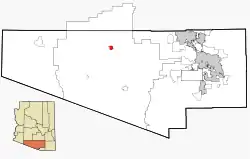 Lage im County und in Arizona | |
| Basisdaten | |
| Staat: | Vereinigte Staaten |
| Bundesstaat: | Arizona |
| County: | Pima County |
| Koordinaten: | 32° 19′ N, 112° 2′ W |
| Zeitzone: | Mountain Standard Time (UTC−7) |
| Einwohner: | 474 (Stand: 2020) |
| Fläche: | 14,8 km² (ca. 6 mi²) davon 14,8 km² (ca. 6 mi²) Land |
| Höhe: | 552 m |
| FIPS: | 04-64310 |
| GNIS-ID: | 0005407 |
This article is issued from Wikipedia. The text is licensed under Creative Commons - Attribution - Sharealike. The authors of the article are listed here. Additional terms may apply for the media files, click on images to show image meta data.