Santa Fé do Araguaia
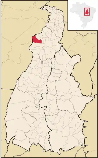
Santa Fé do Araguaia ist eine brasilianische politische Gemeinde im Bundesstaat Tocantins in der Mesoregion Norden und in der Mikroregion Araguaína. Im Jahr 2019 lebten hier schätzungsweise 7.512 Einwohner auf 1.678,091 km².
| Santa Fé do Araguaia (Tocantins) | ||||
|---|---|---|---|---|
| Karte | ||||
 Lage von Santa Fé do Araguaia im Bundesstaat Tocantines | ||||
| Basisdaten | ||||
| Staat: | ||||
| Verwaltungsgliederung: | Norden (Região Norte) | |||
| Bundesstaat: | ||||
| Mesoregion: | Ocidental do Tocantins | |||
| Mikroregion: | Araguaína (TO) | |||
| Geografische Lage: | 7° 9′ S, 48° 43′ W | |||
| Zeitzone: | UTC-3 Sommer: UTC-2 | |||
| Höhe ü. d. M.: | 190 m ü. NN | |||
| Fläche: | 1.676,945 km² | |||
| Einwohner: | 6.599 IBGE/2010 | |||
| Bevölkerungsdichte: | 3,4 Einwohner/km² | |||
| Telefonvorwahl: | ||||
| Postleitzahl (CEP): | ||||
Weblinks
- IBGE: Cidades@ Tocantins: Santa Fé do Araguaia. Abgerufen am 28. August 2019 (brasilianisches Portugiesisch).
This article is issued from Wikipedia. The text is licensed under Creative Commons - Attribution - Sharealike. The authors of the article are listed here. Additional terms may apply for the media files, click on images to show image meta data.
