River Ribble
Der River Ribble ist ein Fluss, der im Norden Englands North Yorkshire und Lancashire durchquert. Das Einzugsgebiet umfasst außerdem Teile von Greater Manchester bei Wigan. Das Tal des Flusses wird Ribblesdale genannt.
| River Ribble | ||
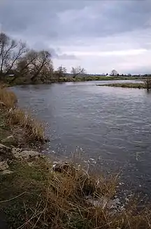 Der River Ribble bei Ribchester Der River Ribble bei Ribchester | ||
| Daten | ||
| Lage | North Yorkshire und Lancashire, England | |
| Flusssystem | River Ribble | |
| Flussgebietseinheit | North West | |
| Ursprung | Zusammenfluss von Gayle Beck und Ribblehead 54° 12′ 29″ N, 2° 20′ 47″ W | |
| Quellhöhe | 280 m ASL | |
| Mündung | Irische See bei Lytham St Annes 53° 43′ 44″ N, 2° 56′ 31″ W | |
| Mündungshöhe | 0 m ASL | |
| Höhenunterschied | 280 m | |
| Sohlgefälle | 2,3 ‰ | |
| Länge | 121 km | |
| Linke Nebenflüsse | River Calder, River Darwen, River Douglas | |
| Rechte Nebenflüsse | River Hodder | |
| Großstädte | Preston | |
| Kleinstädte | Settle, Clitheroe | |
Geographie
Der Ribble hat seinen Ursprung im Zusammenfluss von Gayle Beck und dem Ribblehead nahe dem Ribblehead-Viadukt bei den Yorkshire Three Peaks.
Der Fluss fließt durch Settle, Clitheroe und Preston, bevor er sich zwischen Lytham St. Annes und Southport in die Irische See ergießt.
Die Hauptzuflüsse des Ribble sind der Hodder und der Calder, die nahe Great Mitton münden, der Darwen, der in Walton-le-Dale hinzukommt, und der Douglas, der bei Hesketh Bank mündet.
Der Fluss ist mit dem Leeds and Liverpool Canal sowie mit dem Lancaster Canal verbunden (via Ribble Link). Flussabwärts von Preston wurde der Ribble ausgeschachtet, als Preston ein aktiver Hafen war; dies wird nicht mehr getan und Schlick aus dem Fluss verbreitet sich jetzt weiter über die (sandigen) Buchten um Fairhaven und St. Annes.
Die Mündung des Ribble bildet einen Teil der Ribble and Alt Estuaries Special Protection Area für Wildtiere.
Geschichte
Der Ribble Way ist ein Fernwanderweg, der dem Fluss weitgehend folgt. Der Ribble markierte die Nordgrenze des alten Königreichs Mercia.[1] Zur Zeit des Domesday Book bildete der Fluss die nördliche Grenze eines Gebietes (bekannt als Inter Ripam et Mersham), das laut dem Domesday Book zu Cheshire gehörte,[2] obwohl es wahrscheinlich nicht formell Teil der Grafschaft Cheshire war.[3][4][5]
Der Ribble war zu Römerzeiten anscheinend als "Belisama" bekannt,[6] was möglicherweise namensgebend für Samlesbury war. Ptolemäus' "Belisama aest." spielt möglicherweise auf das Mündungsgebiet des Flusses an.
Die Ufer des Ribble sind ein möglicher Austragungsort der zehnten Schlacht König Artus'. Nennius situiert diese in seiner Historia Brittonum am Ufer eines Flusses namens "Tribruit".[7]
Öffentliche Arbeiten
Die Staumenge des River Ribble wird von der Mersey Basin Campaign betreut, einer Partnerschaft, die 1985 gegründet wurde, um die Wasserqualität zu verbessern und die Uferregeneration zu unterstützen.
Der Stadtrat von Preston veröffentlichte in seinen Vorschlägen zu Flussarbeiten kontroverse Pläne betreffend einem Staudammbau über den Ribble. Das Ziel dieser Vorschläge ist der Bau eines Wassersportparks an einem Abschnitt des Flusses, gemeinsam mit über 4000 Wohneinheiten und Geschäften in der Flussaue. Anwohner setzen sich diesen Plänen entgegen. Ihre Argumente sind die Gefährdung des Wildlebens, erhöhte Überschwemmungsrisiken und Schäden an Grüngürteln. Diese Anwohner haben die "Save the Ribble"-Kampagne gestartet. Teile des Flusses sind eine County Biological Heritage Site.
Ortschaften
- Horton in Ribblesdale
- Stainforth
- Stackhouse
- Langcliffe
- Giggleswick
- Nappa
- Settle
- Halton West
- Paythorne
- Sawley
- West Bradford
- Horrocksford
- Clitheroe
- Great Mitton
- Little Town
- Ribchester
- Samlesbury
- Walton-le-Dale
- Preston
- Penwortham
- Lytham St Annes
Nebenflüsse
Mündung bis Douglas
- Crossens Pool
- The Sluice
- Middle Drain
- Back Drain
- Ring Ditch
- Boundary Drain
- Tarleton Runner
- Mere Brow
- School Drain
- Pale Ditch
- Mere Brow
- Mere Brow Watercourse
- Midge Hall Drain
- Boat House Sluice
- Langley's Brook
- Rufford Boundary Sluice
- Three Pools Waterway
- Fine Jane's Brook
- Holly Brook
- Sandy Brook
- Old Canal
- Boundary Brook
- New Cut Brook
- Sandy Brook
- The Old Pool
- Black Brook
- Drummersdale Drain
- Brook Cut and Mill Stream
- Bullen's Brook
- Eas Brook
- Hurlston Brook
- Fine Jane's Brook
- The Sluice
- Main Drain
- Liggard Brook
- Wrea Brook
- Hundred End Gutter
- Pool Stream
Einzugsbereich des River Douglas
- River Douglas oder River Asland
- Longton Brook
- Centre Drain
- Carr Heys Watercourse
- Tarra Carr Gutter
- Hall Pool
- Dunkirk Dib
- Rakes Brook
- Carr Brook
- Strine Brook
- River Yarrow
- River Lostock
- Wymott Brook
- Clayton Brook
- Slack Brook
- Whave’s Brook
- Spent Brook
- Syd Brook
- Howe Brook
- Pye Brook
- Culbeck Brook
- Chapel Brook
- Ransnap Brook
- German Brook
- Chapel Brook
- Hodge Brook
- River Chor
- Clancutt Brook
- Tanyard Brook
- Whittle Brook
- Eller Brook
- Moss Ditch
- Black Brook
- Tan House Brook
- Warth Brook
- Brinscall Brook
- Fill Brook
- Roaring Lum
- Dean Brook
- Hall Brook
- Cote Slack
- Limestone Brook
- Green Withins Brook
- River Lostock
- The Sluice
- Mill
- Old Reed Brook
- Main Ditch
- Eller Brook
- Wham Ditch
- Black Brook
- Abbey Brook
- New Park Brook
- Castle Brook
- Sefton Brook
- Dungeon Brook
- Dicket's Brook
- Goose Brook
- Mill Ditch
- New Reed Brook
- Bentley Brook
- River Tawd
- Slate Brook
- Grimshaw Brook
- Middlehurst Brook
- Dock Brook
- Alder Lane Brook
- Sprodley Brook
- Calico Brook
- Lees Brook
- Dean Brook
- Sand Brook
- Ackhurst Brook
- Mill Brook
- Bradshaw Brook
- Close Brook
- Barley Brook
- Smithy Brook
- Poolstock Brook
- Ince Brook
- Hawkley Brook
- Reed Brook
- Park Brook
- Ince Brook
- Poolstock Brook
- Clarington Brook
- Bradley Brook
- Bucklow Brook
- Moss Ditch
- Buckow Brook
- Hic-bibi Brook
- Stars Brook
- Almond Brook
- Tunley Brook
- Stars Brook
- Hic-bibi Brook
- Pearl Brook
- Arley Brook
Douglas bis Preston
- Freckleton Pool
- Dow Brook
- Spen Brook
- Carr Brook
- Wrongway Brook
- Middle Pool
- Dow Brook
- Savick Brook
- Deepdale Brook
- Lady Head Runnel
- Sharoe Brook
- Moss Leach Brook
- Eaves Brook
- Mill Brook
- The Mains Brook
Einzugsgebiet des River Darwen
- River Darwen
- Hennel Brook
- Cockshott Brook
- Many Brooks
- Black Brook
- Hatchwood Brook
- Fowler Brook
- Drum Head Brook
- Gorton Brook
- Mill Brook
- Bank Head Brook
- Drum Head Brook
- Black Brook
- Old Darwen
- Beeston Brook
- Quaker Brook
- Hole Brook
- Huntley Brook (North)
- Huntley Brook (South)
- Alum House Brook
- Arley Brook
- Trout Brook
- River Roddlesworth
- Finnington Brook
- Stockclough Brook
- Whitehalgh Brook
- Shaw Brook
- Chapels Brook
- Sheep Bridge Brook
- Whitehalgh Brook
- Rake Brook
- Calf Hey Brook
- Ferny Bed Springs
- River Blakewater
- Snig Brook
- Audley Brook
- Little Harwood Brook
- Royshaw Clough
- Seven Acre Brook
- Knuzden Brook
- Scotshaw Brook
- Moss Brook
- Badger Brook
- Higher Croft Brook
- Newfield Brook
- Davy Field Brook
- Flash Brook
- Grimshaw Brook
- Waterside Brook
- Mean Brook
- Sapling Clough
- Hoddlesden Moss Brook
- Far Scotland Brook
- Pickup Bank Brook
- Moss Brook
- Twitchells Brook
- Mean Brook
- Waterside Brook
- Sunnyhurst Brook
- Stepback Brook
- Bold Venture Brook
- High Lumb Brook
- Livesey Brook
- High Lumb Brook
- Kebbs Brook
- Green Lowe Brook
- Bury Fold Brook
- Old Briggs Brook
- Duckshaw Brook
- Old Briggs Brook
- Grain Brook
- Bent Hall Brook
- Deadman's Clough
- Hennel Brook
Preston bis Whalley
- Swill Brook
- Bezza Brook
- Wilcock Brook
- Mellor Brook
- Wilcock Brook
- Tun Brook
- Stydd Brook
- Boyce’s Brook
- Cowley Brook
- Page Brook
- Duddel Brook
- Boyce’s Brook
- Starling Brook
- Dean Brook
- Bailey Brook
- Brownslow Brook
- Dinckley Brook
- Park Brook
- Blockers Brook
- Showley Brook
- Tottering Brook
- Zechariah Brook
- Park Brook
Einzugsgebiet des River Calder
- River Calder (Ribble)
- Bushburn Brook
- Dean Brook
- Egg Syke Brook
- Rodger Hey Brook
- Sabden Brook
- Badger Well Water
- Wood House Brook
- Cock Clough
- Clough Syke Brook
- Hyndburn Brook
- Harwood Brook
- Causeway Brook
- Norden Brook
- Spaw Brook
- Shaw Brook
- Bottom Syke
- River Hyndburn
- Church Brook
- Accrington Brook
- Woodnook Water
- Warmden Brook
- Tom Dale Clough
- Woodnook Water
- Accrington Brook
- Church Brook
- White Ash Brook
- Wolfenden Syke
- Lottice Brook
- Tinker Brook
- Whams Brook
- Jackhouse Brook
- Cocker Brook
- White Syke
- Cocker Lumb
- Cocker Brook
- Harwood Brook
- Syke Side Brook
- Clough Brook
- Simonstone Brook
- Shorten Brook
- Dean Brook
- Huntroyde Brook
- Castle Clough Brook
- Castle Clough
- Green Brook
- Shaw Brook
- Sweet Clough
- Hapton Clough
- Thorny Bank Clough
- Tower Brook
- Habergham Clough
- New Barn Clough
- Helm Clough
- Micklehurst Clough
- Long Syke
- New Barn Clough
- Whitaker Clough
- Fir Trees Brook
- West Close Clough
- Acres Brook
- Fir Trees Brook
- Moor Isles Clough
- Spurn Clough
- Pendle Water
- Old Laund Clough
- Edge End Brook
- Walverden Water
- Bradley Syke
- Head Beck
- Dobson Syke
- Catlow Brook
- Pighole Clough
- Pathole Beck
- New Laithe Clough
- Float Bridge Beck
- Swains Plat Clough
- Colne Water
- Swinden Clough
- Wanless Water
- Slipper Hill Clough
- Houses Beck Moss
- Moss Houses Beck
- Guy Syke
- Church Clough Brook
- Trawden Brook
- Beardshaw Beck
- Round Hole Beck
- Will Moor Clough
- River Laneshaw
- High Laith Beck
- Sykes Beck
- Shawhead Beck
- Monkroyd Beck
- Hullown Beck
- Swamp Syke
- Laneshaw Brook
- Round Holes Beck
- Cat Stone Clough
- High Laith Beck
- Wycoller Beck
- Ratten Clough
- Smithy Clough
- Deep Clough Beck
- Nan Hole Clough
- Turnhole Clough
- Butter Leach Clough
- Stack Hill Clough
- Blacko Water
- Castor Gill
- Claude's Clough
- Admergill Water
- Wicken Clough
- Greystone Clough
- Sandyford Clough
- White Hough Water
- Dimpenley Clough
- Bird Holme Clough
- Barley Water
- Deep Clough
- Black Moss Water
- Water Gate
- Warth Beck
- Ogden Clough
- Boar Clough
- White Slacks
- Dry Clough
- Barden Clough
- River Brun
- River Don
- Walshaw Clough
- Thursden Brook
- Ell Clough
- Black Clough
- Hey Stacks Clough
- Tom Groove
- Swinden Water
- Hell Clough
- Hurstwood Brook
- Smallshaw Clough
- Rock Water
- River Don
- Everage Clough
- Hole House Clough
- Buck Clough
- Hole House Clough
- Dick Clough
- Easden Clough
- Black Clough
- Green Clough
- Copy Clough
Einzugsgebiet River Hodder
- River Hodder
- Cow Ark Brook
- Mill Brook
- Hagg Clough
- River Loud
- Leagram Brook
- Hill Clough
- Burnslack Brook
- Chipping Brook
- Leagram Brook
- Greystoneley Brook
- Hell Clough
- Dinkling Green Brook
- Withins Clough
- Red Syke
- Fielding Clough
- Langden Brook
- Hareden Brook
- Lane Foot Brook
- Fog Hill Clough
- Cherry Gutter
- Crackling Syke
- Dimples Clough
- Lane Foot Brook
- Losterdale Brook
- Mere Clough Wham
- Bleadale Water
- Stransdale Brook
- Stransdale Gutter
- Hareden Brook
- Robin Clough
- River Dunsop
- Brennand River
- Round Hill Water
- Brown Syke
- Round Hill Water
- Whitendale River
- Sandy Gutter
- Brennand River
- Black Brook
- Rough Syke
- Grey Gill
- Heaning Brook
- Birkett Brook
- Crimpton Brook
- Foulscales Brook
- Bonstone Brook
- Crag Beck
- Easington Brook
- Sough Clough
- Rye Clough
- Skelshaw Brook
- Langcliff Cross Brook
- Tinklers Brook
- Anna Land Brook
- Tinklers Brook
- Harrop Brook
- Dean Slack Brook
- King Syke
- Dunnow Syke
- Croasdale Brook
- Eller Beck
- Lanshaw Brook
- Davison's Syke
- Clough Beck
- Dunsop Brook
- Hill Wood Syke
- Moor Syke
- Round Hill Syke
- Black Brook
- Hind Slack
- Barn Gill
- Park Beck
- Dugdale Syke
- Phynis Beck
- Wain Hill Syke
- Bottoms Beck
- Hesbert Hall Syke
- Hindley Head Clough
- Thorp Syke
- Dob Dale Beck
- Nursery Beck
- Brock Clough Beck
- Brown Hills Beck
- Ash Clough Swamp
- Nursery Beck
- Hasgill Beck
- Cowgill Syke
- Rigg Gill Syke
- Copter Syke
- Hare Clough Beck
- White Syke
- Kearsden Holes
- Red Syke
- Cow Ark Brook
Whalley bis Paythorne
- Barrow Brook
- Pig Hill Brook
- Barrow Clough
- Pendleton Brook
- Mearley Brook
- Shaw Brook
- Worston Brook
- Rad Brook
- Howcroft Brook
- Mearley Brook
- Bashall Brook
- Hollins Clough
- Cow Hey Brook
- Sandy Ford Brook
- Braddup Clough
- Elm Clough
- Waddington Brook
- Coplow Brook
- Greg Sike
- West Bradford Brook
- Brocklehurst Brook
- Drakehouse Brook
- Porters Brook
- Bradford Brook
- Porters Brook
- Moor Roads Sike
- West Clough Brook
- Grindleton Brook
- Chatburn Brook
- Smithies Brook
- Swanside Beck
- Stankhill Beck
- Gazegill or Rimington Beck
- Thistleber Beck
- Eel Beck
- Widow Hill Beck
- Eel Beck
- Skell Banks Syke
- Howgill Beck
- Whytha Beck
- Collaver Syke
- Crag Clough
- Thistleber Beck
- Gazegill or Rimington Beck
- Dudland Syke
- Cow Gill Beck
- Stankhill Beck
- Ings Beck
- Twiston Beck
- Pendle Hill Brook
- Clough Beck
- Gill Beck
- Twiston Beck
- Swanside Beck
- Rathmill Sike
- Hollins Syke
- Skinners Sike
- Sliping Brook
- Hell Syke
- Hill Brook
- Skirden Beck
- Holden Beck
- Mear Gill
- Fell Brook
- Bay Gate Brook
- Far Fields Brook
- Black Brook
- Holden Beck
- Threap Green Brook
- Fell Brook
- Mear Gill
- Kirk Beck
- Fox Gill Beck
- Gill Bottom Beck
- Fox Gill Beck
- Bier Beck
- Hungrill Beck
- Higher Syke
- Bleara Syke
- Varleys Syke
- Higher Syke
- Cuddy Syke
- Hungrill Beck
- Monubent Beck
- Hen Gill Beck
- Agden Beck
- Mere Syke
- Agden Beck
- Hen Gill Beck
- Grunsagill Beck
- Tosside Beck
- Holden Beck
- Tosside Beck
- New Gill Beck
- Bond Beck
- Little Beck
- Sandy Syke
- Walkers Clough
- Bond Beck
- Holden Beck
- Fooden Gill
- Park House Beck
- Wheatley Beck
- Ellenthorpe Gill
Paythorne bis zur Quelle
- Stock Beck
- Spittle Syke
- Horton Beck
- Bottom Beck
- Lodge Hill Syke
- Old Park Syke
- Wedacre Syke
- Hesketh Rough Syke
- Old Park Syke
- Lodge Hill Syke
- Flush Beck
- Hell Forest Dike
- Turpit Gate Syke
- Hayfield Dike
- Tosber Syke
- Fools Syke
- Ray Gill Water
- Ray Gill
- Horrox Gill
- Ray Gill Water
- Crownest Syke
- Gillians Beck
- Moor Side Beck
- East Beck
- Carholme Beck
- Ray Gill
- Ged Beck
- Swinden Gill Beck
- Mallardale Beck
- Mansell Beck
- Pan Beck
- Hellifield Beck
- Gallaber Syke
- Bend Gate Syke
- Kell Well Beck
- Candle Rush Beck
- Deep Dale Syke
- Long Preston Beck
- Bookil Gill Beck
- Scaleber Beck
- Old Field Syke
- Crow Hill Syke
- Wigglesworth Beck
- Tofts Syke
- Rough Syke
- Rathmell Beck
- Hollow Gill Beck
- Rathmell Goit
- Skir Beck
- Mear Beck
- Swaw Beck
- Carr Beck
- Tems Beck
- Huntworth Beck
- Lodge Gill
- Stainforth Beck
- Catrigg Beck
- Cowside Beck
- Tongue Gill
- Fornah Gill
- Catrigg Beck
- How Beck
- Blind Beck
- Turn Dub
- Selside Beck
- Gillgarth Beck
- Coppy Gill
- Cosh Knott Well
Cam Beck
- Cam Beck
- Brow Gill Beck
- Ling Gill Beck
- Labour Gill
- Poverty Gill
- Hard Turf Gill
- Dry Gill
- Little Bank Gill
- Foul Gutter
- Rush Gill
- Lamb Fold Gill
- Little Intake Gill
- Middle Gill
- Tur Gill
- Grainings Gill
- Red Sike
- Pot Close Gill
- Battywife Beck
- Blind Beck
Gayle Beck
- Gayle Beck
- Axletree Gill
- Gate Cote Gill
- White Earth Gill
- High Springs
- Lat Gill
- Long Gill
- Mares Gill
- Far Mares Gill
- Shivery Gill
- Jam Sike
- Ouster Gill
Name
Der River Ribble ist namensgebend für den Borough Ribble Valley und den gleichnamigen Wahlkreis sowie für die Gemeinde South Ribble. Die Ribble-Busgesellschaft betrieb einst Busse in Nordwestengland. Außerdem nennen sich Ribble Steam Railway, Ribble Cycles, ein Fahrradhersteller aus Preston, und Ribble Valley Inns nach dem Fluss.
Quellen
Einzelnachweise und Anmerkungen
- River Ribble Information (PDF-Datei) (Seite nicht mehr abrufbar, Suche in Webarchiven) Info: Der Link wurde automatisch als defekt markiert. Bitte prüfe den Link gemäß Anleitung und entferne dann diesen Hinweis. Mersey Basin Campaign Official Website. Eingesehen am 26. Januar 2008
- Morgan (1978). S. 269c–301c,d.
- Harris and Thacker (1987). Seite 252: "Sicherlich gab es vor 1000 Verbindungen zwischen Cheshire und der südlichen Lancashire, als Wulfric Spot in beiden Gebieten Land besaß. Wulfrics Güter blieben nach seinem Tod beisammen, als sie an seinen Bruder Aelfhelm gingen, und es scheint noch 1086 eine Verbindung gegeben zu haben, als die südliche Lancashire gemeinsam mit Cheshire von den Domesday-Beauftragten untersucht wurde. Trotzdem scheinen die zwei Gebiete irgendwie voneinander verschieden gewesen zu sein, und es ist nicht sicher, dass die in der Lancashire-Sektion des Domesday Book erwähnten Shire-Moot und Vögte jene von Cheshire waren."
- Phillips und Phillips (2002). S. 26–31.
- Crosby, A. (1996). S. 31: "Die Untersuchung für das Domesday Book (1086) schloss die südliche Lancashire aus Bequemlichkeit mit Cheshire zusammen, doch der Mersey, was "Grenzfluss" bedeutet, hat bekanntermassen die Königreiche Northumbria und Mercia voneinander getrennt, und es besteht kein Zweifel, dass dies die echte Grenze war."
- Hutton, S. 218
- „Lucius Artorius Castus Part 2: The Battles in Britain“ by Linda A. Malcor, Aliso Viejo, California (Memento vom 16. Juni 2012 im Internet Archive) (engl., aus The Heroic Age, USA 1999)
Bibliografie
- A. Crosby (1996): A History of Cheshire. (The Darwen County History Series.) Chichester, West Sussex, UK: Phillimore & Co. Ltd. ISBN 0850339324.
- B. E. Harris und A. T. Thacker (1987): The Victoria History of the County of Chester. (Band 1: Physique, Prehistory, Roman, Anglo-Saxon, and Domesday): Oxford: Oxford University Press. ISBN 0197227619.
- Ronald Hutton (1991): The Pagan Religions of the Ancient British Isles, Oxford: Blackwell, ISBN 0631172882
- P. Morgan (1978): Domesday Book Cheshire: Including Lancashire, Cumbria, and North Wales. Chichester, Sussex: Phillimore & Co. Ltd. ISBN 0850331404.
- A. D. M. und C. B. Phillips (2002): A New Historical Atlas of Cheshire. Chester, UK: Cheshire County Council and Cheshire Community Council Publications Trust. ISBN 0904532461.