Restipass
Der Restipass ist der Übergang von Leukerbad ins Lötschental. Auf der Passhöhe von 2626 m ü. M. verläuft die Grenze zwischen den Gemeinden Leuk und Ferden.
| Restipass | |||
|---|---|---|---|
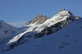 Restipass (links) von Osten Restipass (links) von Osten | |||
| Himmelsrichtung | Südwest | Nordost | |
| Passhöhe | 2626 m ü. M. | ||
| Kanton | Wallis | Wallis | |
| Talorte | Leukerbad | Ferden | |
| Profil | |||
| Ø-Steigung | % (1225 m / ? km) | % (1251 m / ? km) | |
| Karte (Wallis) | |||
| |||
| Koordinaten | 620609 / 136484 | ||
This article is issued from Wikipedia. The text is licensed under Creative Commons - Attribution - Sharealike. The authors of the article are listed here. Additional terms may apply for the media files, click on images to show image meta data.