Pottsville (Arkansas)
Pottsville ist eine Kleinstadt im Pope County im US-Bundesstaat Arkansas. Sie liegt etwa 105 km westlich von Little Rock und etwa 135 km östlich von Fort Smith.
| Pottsville | |
|---|---|
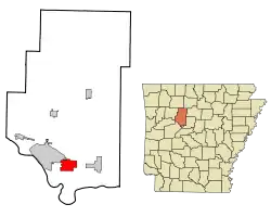 Lage im County und in Arkansas | |
| Basisdaten | |
| Staat: | Vereinigte Staaten |
| Bundesstaat: | Arkansas |
| County: | Pope County |
| Koordinaten: | 35° 15′ N, 93° 3′ W |
| Zeitzone: | Central (UTC−6/−5) |
| Einwohner: | 3.140 (Stand: 2020) |
| Fläche: | 19,4 km² (ca. 7 mi²) davon 19,4 km² (ca. 7 mi²) Land |
| Höhe: | 116 m |
| Postleitzahl: | 72858 |
| Vorwahl: | +1 479 |
| FIPS: | 05-56990 |
| GNIS-ID: | 0078087 |
Nach der Volkszählung von 2000 zählte die Stadt eine Bevölkerung von 1271 Einwohnern. Sie nimmt eine Fläche von 19,5 km² ein. Pottsville grenzt im Norden an Crow Mountain, im Osten an Atkins und im Westen an Russellville.
Bevölkerungsentwicklung
| Bevölkerungsentwicklung | |||
|---|---|---|---|
| Census | Einwohner | ± in % | |
| 1900 | 192 | — | |
| 1910 | 205 | 6,8 % | |
| 1920 | 275 | 34,1 % | |
| 1930 | 293 | 6,5 % | |
| 1940 | 308 | 5,1 % | |
| 1950 | 224 | −27,3 % | |
| 1960 | 250 | 11,6 % | |
| 1970 | 411 | 64,4 % | |
| 1980 | 564 | 37,2 % | |
| 1990 | 984 | 74,5 % | |
| 2000 | 1271 | 29,2 % | |
| 1900–2000[1] | |||
Einzelnachweise
- Auszug aus der Encyclopedia of Arkansas. Abgerufen am 13. Februar 2011
This article is issued from Wikipedia. The text is licensed under Creative Commons - Attribution - Sharealike. The authors of the article are listed here. Additional terms may apply for the media files, click on images to show image meta data.