Pagosa Springs
Pagosa Springs ist eine Stadt im Archuleta County im US-Bundesstaat Colorado der Vereinigten Staaten mit 1727 Einwohnern (Stand: 2010) und Sitz der County-Verwaltung. Die geographischen Koordinaten sind 39,91° Nord, 104,98° West. Das Einzugsgebiet der Stadt beträgt 11,4 km².
| Pagosa Springs | |||
|---|---|---|---|
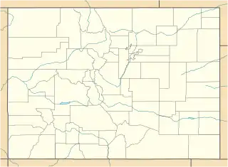
Lage in Colorado | |||
| Basisdaten | |||
| Staat: | Vereinigte Staaten | ||
| Bundesstaat: | Colorado | ||
| County: | Archuleta County | ||
| Koordinaten: | 37° 16′ N, 107° 1′ W | ||
| Zeitzone: | Mountain (UTC−7/−6) | ||
| Einwohner: | 1.571 (Stand: 2020) | ||
| Fläche: | 11,4 km² (ca. 4 mi²) davon 11,4 km² (ca. 4 mi²) Land | ||
| Höhe: | 2172 m | ||
| Postleitzahlen: | 81147, 81157 | ||
| Vorwahl: | +1 970 | ||
| FIPS: | 08-56860 | ||
| GNIS-ID: | 0184338 | ||
| Website: | www.pagosasprings.co.gov | ||
| Bürgermeister: | Ross Aragon | ||
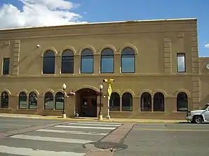 County Courthouse in Pagosa Springs | |||
Weblinks
Commons: Pagosa Springs – Sammlung von Bildern, Videos und Audiodateien
- Offizieller Internetauftritt der Stadt Pagosa Springs (englisch)
This article is issued from Wikipedia. The text is licensed under Creative Commons - Attribution - Sharealike. The authors of the article are listed here. Additional terms may apply for the media files, click on images to show image meta data.