Packer Lake (Wyoming)
Der Packer Lake (auch bekannt als Chalupa Lake[1] oder Peters Reservoir[2]) ist ein Stausee im Goshen County im US-Bundesstaat Wyoming.
| Packer Lake | |||||||
|---|---|---|---|---|---|---|---|
| |||||||
| |||||||
| Koordinaten | 41° 54′ 0″ N, 104° 3′ 49″ W | ||||||
| Daten zum Bauwerk | |||||||
| Daten zum Stausee | |||||||
| Höhenlage (bei Stauziel) | 1242 m | ||||||
| Wasseroberfläche | 32 ha | ||||||
| Maximale Tiefe | 3 m (mittl. Tiefe 1 m) | ||||||
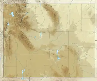
Er befindet sich direkt an der Staatsgrenze zu Nebraska beziehungsweise 2,5 Kilometer südwestlich von Lyman. Der See ist über den Packer Ditch mit dem Horse Creek, einem Zufluss des North Platte River, verbunden, und seine Fläche beträgt etwa 32 Hektar. Die durchschnittliche Tiefe beträgt ca. 1 Meter, die maximale Tiefe gut 3 Meter.[3][4]
Fischarten
Im Packer Lake sind unter anderem folgende Fischarten ansässig:[4][5]
- Amerikanischer Flussbarsch (Perca flavescens)
- Forellenbarsch (Micropterus salmoides)
- Glasaugenbarsch (Sander vitreus)
- Katzenwels (Ictalurus punctatus)
- Regenbogenforelle (Oncorhynchus mykiss)
- Sonnenbarsche (Centrarchidae)
Einzelnachweise
- U.S. Geological Survey. Geographic Names Phase I data compilation (1976-1981). 31-Dec-1981. Primarily from U.S. Geological Survey 1:24,000-scale topographic maps (or 1:25K, Puerto Rico 1:20K) and from U.S. Board on Geographic Names files. In some instances, from 1:62,500 scale or 1:250,000 scale maps
- U.S. Geological Survey. Geographic Names Phase I data compilation (1976-1981). 31-Dec-1981. Primarily from U.S. Geological Survey 1:24,000-scale topographic maps (or 1:25K, Puerto Rico 1:20K) and from U.S. Board on Geographic Names files. In some instances, from 1:62,500 scale or 1:250,000 scale maps
- Packer Lake (Wyoming) im Geographic Names Information System des United States Geological Survey
- The Laramie Region Newsletter (PDF-Datei, 1,2 MB)
- Nonindigenous Aquatic Species
This article is issued from Wikipedia. The text is licensed under Creative Commons - Attribution - Sharealike. The authors of the article are listed here. Additional terms may apply for the media files, click on images to show image meta data.