Ongo Niua
Ongo Niua (für zwei Niuas)[1], auch Niuas, sind eine Inselgruppe im südlichen Pazifik, die politisch zum Königreich Tonga gehört. Der weit im Norden Tongas gelegene Archipel umfasst drei Inseln:
| Ongo Niua | ||
|---|---|---|
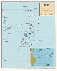 Karte von Tonga, die Niua-Gruppe im äußersten Norden | ||
| Gewässer | Pazifischer Ozean | |
| Geographische Lage | 15° 58′ S, 173° 47′ W | |
| ||
| Anzahl der Inseln | 3 | |
| Hauptinsel | Niuatoputapu | |
| Gesamte Landfläche | 71,7 km² | |
| Einwohner | 1150 (2021) | |
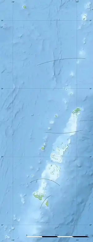
![]() Karte mit allen Koordinaten: OSM | WikiMap
Karte mit allen Koordinaten: OSM | WikiMap
| Insel | Hauptort | Fläche km²[2] | Bevölkerung (2021)[3] | Höhe (Meter) | Koordinaten |
|---|---|---|---|---|---|
| Niuafoʻou | Esia | 50,27 | 431 | 250 | 15° 36′ 12″ S, 175° 38′ 13″ W |
| Niuatoputapu | Hihifo | 18,00 | 691 | 157 | 15° 57′ 34″ S, 173° 47′ 0″ W |
| Tafahi | Tafahi | 3,42 | 28 | 560 | 15° 51′ 0″ S, 173° 43′ 0″ W |
| Niuas | Hihifo | 71,69 | 1150 | 560 | 15° 58′ S, 173° 47′ W |
Diese Inseln sind die aus dem Meer ragenden Spitzen unterseeischer Vulkane, die zum Teil noch bis in die jüngste Zeit aktiv waren. Die Niua-Gruppe wurde 1616 von Willem Cornelisz Schouten und Jacob Le Maire während ihrer Weltumseglung mit den Schiffen Eendracht und Hoorn für Europa entdeckt.
| Insel | Tongatapu | Neiafu |
|---|---|---|
| Niuafoʻou | 615 | 380 |
| Niuatoputapu | 595 | 300 |
| Tafahi | 608 | 312 |
Einzelnachweise
- Electoral Boundaries Regulations 2014. Government of Tonga. Abgerufen am 4. September 2017.
- Geohive: Tonga
- Kingdom of Tonga: Population - Tongatapu, 'Eua, Ha'apai, Vava'u, Niuas (As of 17 January 2022). In: World Economic Outlook Database. UN Office for the Coordination of Humanitarian Affairs, 17. Januar 2022, abgerufen am 23. Januar 2022 (englisch).
Niua-Gruppe: Niuafoʻou | Niuatoputapu | Tafahi
Vavaʻu-Gruppe: Fonualei | Late | Toku | Vavaʻu
Haʻapai-Gruppe: Fatumanongi | Foa | Fotuhaʻa | Haʻano | Hakauata | Hunga Tonga | Kao | Lifuka | Limu | Lofanga | Luahoko | Luangahu | Meama | Niniva | Nomuka | Nukupule | Ofolanga | Tofua | ʻUiha | Uoleva | Uonukuhahake
Tongatapu-Gruppe: ʻAta | ʻEua | Tongatapu
Umstrittenes Gebiet: Minerva-Riffe