Naan Kuro
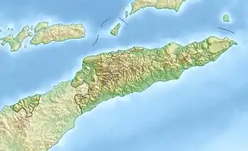
Naan Kuro ist eine Salzlagune, die sich entlang der Hälfte der Küste des osttimoresischen Verwaltungsamts Barique (Gemeinde Manatuto) erstreckt. Im Westen beginnt die Lagune im Suco Uma Boco und erstreckt sich bis in die Mitte der Küste des Sucos Aubeon.[1]
| Naan Kuro | ||
|---|---|---|
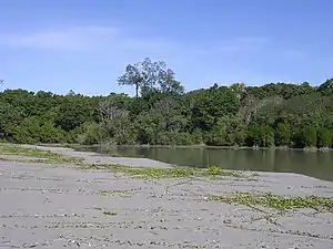 | ||
| Mangroven und der Sandstreifen zwischen Meer und der Lagune im Suco Uma Boco | ||
| Geographische Lage | Barique, Osttimor | |
| Daten | ||
| Koordinaten | 9° 1′ 53″ S, 126° 5′ 13″ O | |
| ||
Das Feuchtgebiet erstreckt sich über 100 Hektar. Es gehört zur Important Bird Area Sungai Clere, die auch ein Wildschutzgebiet ist.[2]
Einzelnachweise
- Timor-Leste GIS-Portal (Memento vom 30. Juni 2007 im Internet Archive)
- Colin R. Trainor: The waterbirds and coastal seabirds of Timor-Leste: new site records clarifying residence status, distribution and taxonomy, abgerufen am 19. April 2014
Änderung der administrativen Grenzen Osttimor
Die administrativen Grenzen innerhalb Osttimors haben sich 2015 geändert. Dieser Artikel muss daher geprüft und gegebenenfalls aktualisiert werden. Siehe Neue administrative Grenzen.
This article is issued from Wikipedia. The text is licensed under Creative Commons - Attribution - Sharealike. The authors of the article are listed here. Additional terms may apply for the media files, click on images to show image meta data.