Mount Peulik
Mount Peulik, auch Ugashik-Peulik, ist ein Stratovulkan auf der Alaska-Halbinsel im US-Bundesstaat Alaska.
| Mount Peulik | ||
|---|---|---|
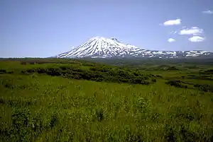
Mount Peulik von Norden | ||
| Höhe | 1474 m | |
| Lage | Alaska, USA | |
| Gebirge | Aleutenkette | |
| Koordinaten | 57° 45′ 4″ N, 156° 22′ 5″ W | |
| ||
| Typ | Stratovulkan | |
| Letzte Eruption | 1814 | |
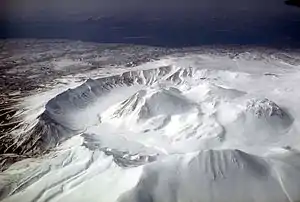
Ugashik-Caldera, Luftbild, Blickrichtung Südwest | ||
Er liegt als Teil der Aleutenkette südlich des Becharof Lake im Lake and Peninsula Borough nördlich der Ugashik-Caldera und ist 1474 m hoch. Sein letzter Ausbruch fand 1814 statt.
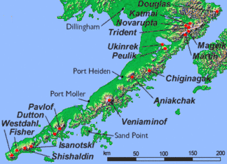
Karte mit Vulkanen Alaskas
Weblinks
Commons: Ugashik-Peulik – Sammlung von Bildern, Videos und Audiodateien
- Ugashik-Peulik im Global Volcanism Program der Smithsonian Institution (englisch)
- Volcanoes of the Alaska Peninsula and Aleutian Islands – mit Link zu Fotos
- Alaska Volcano Observatory
This article is issued from Wikipedia. The text is licensed under Creative Commons - Attribution - Sharealike. The authors of the article are listed here. Additional terms may apply for the media files, click on images to show image meta data.