Mount Kaguyak
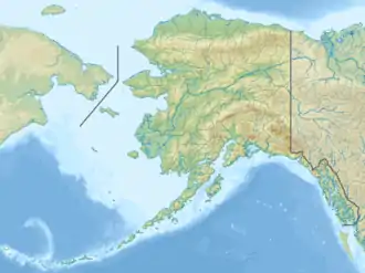
Der Mount Kaguyak ist ein 901 m hoher Schichtvulkan in der Aleutenkette auf der Alaska-Halbinsel. Er liegt im Nordosten des Katmai-Nationalparks.
| Mount Kaguyak | ||
|---|---|---|
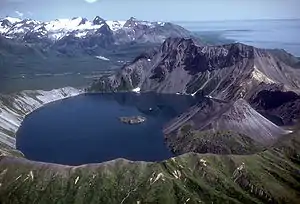
Caldera des Mount Kaguyak | ||
| Höhe | 901 m | |
| Lage | Alaska-Halbinsel (USA) | |
| Gebirge | Aleutenkette | |
| Koordinaten | 58° 36′ 29″ N, 154° 1′ 41″ W | |
| ||
| Typ | Schichtvulkan | |
| Letzte Eruption | ~5800 BP[1] | |
Basierend auf einer Radiokarbondatierung liegt die letzte, die Caldera formende Eruption 5800 Jahre zurück.[1] Der 550 m unter dem höchsten Punkt des Kraterrands liegende Kratersee hat einen Durchmesser von 2,5 km und eine Tiefe von über 180 m.
Einzelnachweise
Weblinks
Commons: Mount Kaguyak – Sammlung von Bildern, Videos und Audiodateien
- Mount Kaguyak im Global Volcanism Program der Smithsonian Institution (englisch)
- Beschreibung des Mount Kaguyak (Alaska Volcano Observatory) (englisch)
This article is issued from Wikipedia. The text is licensed under Creative Commons - Attribution - Sharealike. The authors of the article are listed here. Additional terms may apply for the media files, click on images to show image meta data.