Mount Brooke
Mount Brooke ist ein wuchtiger, isolierter und 2675 m hoher Berg im ostantarktischen Viktorialand. Er ragt 27 km nordwestlich des Mount Gran sowie südlich der Coombs Hills auf und dominiert das Gebiet zwischen den Kopfenden des Mackay- und des Mawson-Gletschers.
| Mount Brooke | ||
|---|---|---|

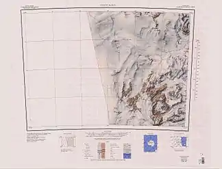
Topographische Karte mit Mount Brooke südlich der Coombs Hills und westlich der Convoy Range (untere Kartenhälfte) | ||
| Höhe | 2675 m | |
| Lage | Viktorialand, Ostantarktika | |
| Gebirge | Transantarktisches Gebirge | |
| Koordinaten | 76° 49′ 13″ S, 159° 54′ 20″ O | |
| ||
Namensgeber des Bergs ist Lieutenant Commander Francis Richard Brooke (* 1926) von der Royal Navy, 1957 Leiter der nördlichen neuseeländischen Vermessungsmannschaft der Commonwealth Trans-Antarctic Expedition (1955–1958).
Weblinks
- Mount Brooke im Geographic Names Information System des United States Geological Survey (englisch)
- Mount Brooke auf geographic.org (englisch)
This article is issued from Wikipedia. The text is licensed under Creative Commons - Attribution - Sharealike. The authors of the article are listed here. Additional terms may apply for the media files, click on images to show image meta data.
