Mosspaul Burn
Der Mosspaul Burn ist ein Wasserlauf in Scottish Borders und Dumfries and Galloway. Er entsteht an der Nordseite des Glenreif Rig und fließt in westlicher Richtung, wobei er die Grenze zwischen Scottish Borders im Norden und Dumfries and Galloway im Süden bildet. Beim Erreichen der Nordostseite des Wisp Hill, wendet er sich in südlicher Richtung und fließt mit der A7 road auf seiner westlichen Seite seinem Zusammentreffen mit dem Carewoodrig Burn entgegen.
| Mosspaul Burn | ||
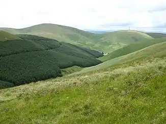 Das Tal des Mosspaul Burn mit dem Blick zur A7 road Das Tal des Mosspaul Burn mit dem Blick zur A7 road | ||
| Daten | ||
| Lage | Scottish Borders, Dumfries and Galloway, Schottland | |
| Flusssystem | River Esk (Solway Firth) | |
| Abfluss über | Ewes Water → River Esk (Solway Firth) → Solway Firth → Irische See | |
| Flussgebietseinheit | Solway Tweed XRBD | |
| Quelle | Nordseite des Glenreif Rig 55° 16′ 41″ N, 2° 55′ 9″ W | |
| Mündung | Zusammenfluss mit dem Carewoodrig Burn 55° 12′ 36″ N, 3° 6′ 22″ W | |
This article is issued from Wikipedia. The text is licensed under Creative Commons - Attribution - Sharealike. The authors of the article are listed here. Additional terms may apply for the media files, click on images to show image meta data.