Molholm Island
Molholm Island ist eine Insel im Archipel der Windmill-Inseln vor der Budd-Küste des ostantarktischen Wilkeslands. Sie liegt in der Einfahrt zur McGrady Cove im östlichen Abschnitt der Newcomb Bay.
| Molholm Island | ||
|---|---|---|
| Gewässer | McGrady Cove | |
| Inselgruppe | Windmill-Inseln | |
| Geographische Lage | 66° 16′ S, 110° 33′ O | |
| ||
| Höchste Erhebung | 17 m | |
| Einwohner | unbewohnt | |
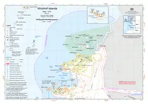 Karte der nördlichen Windmill-Inseln mit Molholm Island (untere Kartenhälfte) | ||

Die Insel wurde anhand von Luftaufnahmen der US-amerikanischen Operation Highjump (1946–1947) kartiert. 1957 nahmen Wissenschaftler der Wilkes-Station unter der Leitung des US-amerikanischen Polarforschers Carl R. Eklund (1909–1962) eine Vermessung vor. Eklund benannte sie nach John Robertson Latady Molholm (* 1938), Glaziologe auf der Wilkes-Station im selben Jahr.
Weblinks
- Molholm Island im Geographic Names Information System des United States Geological Survey (englisch)
- Molholm Island auf geographic.org (englisch)
This article is issued from Wikipedia. The text is licensed under Creative Commons - Attribution - Sharealike. The authors of the article are listed here. Additional terms may apply for the media files, click on images to show image meta data.