Mirkot
Mirkot (Nepali मिरकोट oder Bhirkot) ist ein Village Development Committee (VDC) in Zentral-Nepal im Distrikt Gorkha.
| Mirkot मिरकोट | |||
|---|---|---|---|
| |||
| Koordinaten | 28° 0′ N, 84° 32′ O | ||
| Basisdaten | |||
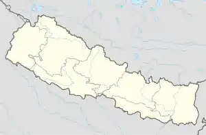
| Staat | Nepal | ||
| Gandaki | |||
| Distrikt | Gorkha | ||
| Höhe | 770 m | ||
| Einwohner | 5261 (2011) | ||
 Landschaft im VDC Mirkot Landschaft im VDC Mirkot | |||
Mirkot liegt 10 km westlich der Distrikthauptstadt Gorkha. Das VDC erstreckt sich über eine Hügellandschaft südlich des Mansiri Himal in Höhen von 400 m bis 1100 m. Der Fluss Daraudi fließt östlich an Mirkot vorbei.
Einwohner
Bei der Volkszählung 2011 hatte das VDC Mirkot 5261 Einwohner (davon 2407 männlich) in 1388 Haushalten.[1]
Dörfer und Hamlets
Mirkot besteht aus mehreren Dörfern und Hamlets.[2] Die wichtigsten sind:
- Britti (415 m ⊙)
- Bagdanda (770 m ⊙)
- Dhaukhola (810 m ⊙)
- Jogigaun (930 m ⊙)
- Kusuntar (490 m ⊙)
- Mohoriya (710 m ⊙)
- Ramche (790 m ⊙)
- Sanabesi (650 m ⊙)
- Sera (470 m ⊙)
- Supare (550 m ⊙)
![]() Karte mit allen Koordinaten des Abschnitts Dörfer und Hamlets: OSM
Karte mit allen Koordinaten des Abschnitts Dörfer und Hamlets: OSM
Weblinks
Commons: Mirkot – Sammlung von Bildern, Videos und Audiodateien
Einzelnachweise
- National Population and Housing Census 2011 (PDF) Central Bureau of Statistics. Archiviert vom Original am 31. Juli 2013.
- District: Gorkha. List of Settlements (PDF) In: Index of Geographical names of Nepal. National Geographic Information Infrastructure Programme. www.ngiip.gov.np. Archiviert vom Original am 6. Februar 2016. Info: Der Archivlink wurde automatisch eingesetzt und noch nicht geprüft. Bitte prüfe Original- und Archivlink gemäß Anleitung und entferne dann diesen Hinweis. Abgerufen am 5. September 2015.
This article is issued from Wikipedia. The text is licensed under Creative Commons - Attribution - Sharealike. The authors of the article are listed here. Additional terms may apply for the media files, click on images to show image meta data.