Melbourne Island
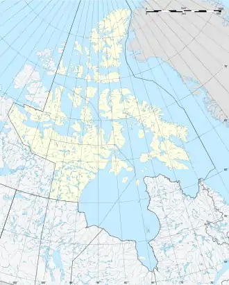
Melbourne Island (Inuktitut: Qitiqtaryuaq) ist eine unbewohnte Insel in der Kitikmeot-Region des kanadischen Territoriums Nunavut.
| Melbourne Island | ||
|---|---|---|
| Gewässer | Queen Maud Gulf | |
| Inselgruppe | Kanadisch-arktischer Archipel | |
| Geographische Lage | 68° 30′ N, 104° 45′ W | |
| ||
| Länge | 28 km | |
| Breite | 16 km | |
| Fläche | 381 km² | |
| Höchste Erhebung | 104 m | |
| Einwohner | unbewohnt | |
Sie liegt am südwestlichen Rand des Queen Maud Gulf. Westlich der Insel schließen sich die Minto Islands an. Nordwestlich von Melbourne Island befindet sich der Isthmus der Kent Peninsula. Nördlich von Melbourne Island liegt Victoria Island.
Melbourne Island hat eine ovale Gestalt. Sie ist von Seen und Sumpfgebieten überzogen. Die Fläche der Insel beträgt 381 km².[1]
Einzelnachweise
- The Atlas of Canada – Sea Islands (Memento vom 6. Oktober 2012 im Internet Archive) (englisch)
This article is issued from Wikipedia. The text is licensed under Creative Commons - Attribution - Sharealike. The authors of the article are listed here. Additional terms may apply for the media files, click on images to show image meta data.
