Maopora
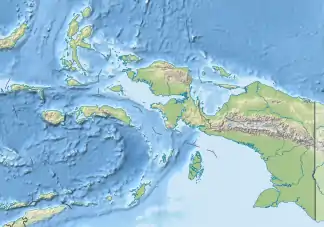
Maopora ist eine der indonesischen Barat-Daya-Inseln (Südwestinseln) in der Bandasee.
| Maopora | ||
|---|---|---|
 Maopora liegt östlich von Romang | ||
| Gewässer | Bandasee | |
| Inselgruppe | Barat-Daya-Inseln | |
| Geographische Lage | 7° 35′ 3″ S, 127° 35′ 49″ O | |
| ||
| Länge | 8 km | |
| Breite | 3,1 km | |
| Fläche | 11,38 km² | |
| Höchste Erhebung | 310 m | |
| Einwohner | unbewohnt | |
Geographie
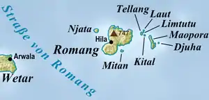
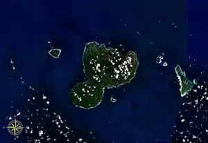
Maopora liegt östlich der Insel Romang
Maopora liegt östlich der Insel Romang. Nordwestlich liegen die kleineren Inseln Tellang, Kital, Limtutu und Laut, östlich ist Maopora das Eiland Djuha vorgelagert. Die Inseln gehören zum Kecamatan (Subdistrikt) Pulau-Pulau Terselatan, Kabupaten (Regierungsbezirk) Südwestmolukken (Maluku Barat Daya), Provinz Maluku.
Die Insel ist unbewohnt, hat eine Fläche von 11,38 km²[1] und erreicht eine Höhe von 310 Metern.[2] Sie gehört zum Desa Jerusu auf Romang.
This article is issued from Wikipedia. The text is licensed under Creative Commons - Attribution - Sharealike. The authors of the article are listed here. Additional terms may apply for the media files, click on images to show image meta data.