Mansfield Hollow State Park
Mansfield Hollow State Park ist ein State Park im US-Bundesstaat Connecticut auf dem Gebiet der Gemeinde Mansfield. Der Park liegt auf 102 ha (251 acre) gepachteten Landes am Westufer des Mansfield Hollow Lake (200 ha). Das Areal gehört zu den Gebieten mit insgesamt 930 ha Fläche, die das Connecticut Department of Energy and Environmental Protection vom U.S. Army Corps of Engineers gepachtet hat, um Freizeitmöglichkeiten und Naturschutz zu fördern.[3]
Mansfield Hollow State Park | ||
 Mansfield Hollow Lake Mansfield Hollow Lake | ||
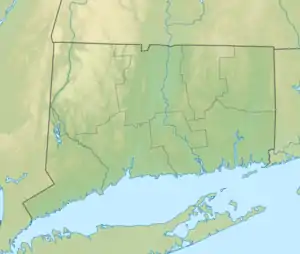
| Lage | Mansfield, Tolland County, USA[1] | |
| Fläche | 1,02 km²[2] | |
| Geographische Lage | 41° 46′ N, 72° 11′ W | |
| ||
| Einrichtungsdatum | 1952 | |
| Verwaltung | Dept. of Energy & Environmental Protection, Connecticut State | |
Merkmale
Der Mansfield Hollow Lake ist ein Stausee, der 1952, unmittelbar vor Errichtung des Parks geschaffen wurde, um Wasserregulation an Quinebaug, Shetucket und Thames zu gewährleisten. Der Stausee liegt in den Turnip Meadows am Zusammenfluss von Fenton River, Mount Hope River und Natchaug River. Geologisch gesehen handelt es sich um ein Gebiet mit vielen Landformen, die durch die letzte Eiszeit entstanden sind: Kamen, Eskers und Kettles.[4] Freizeitmöglichkeiten umfassen Angeln, Bootfahren, Picknicken, Wandern und Mountainbike fahren, sowie Skilaufen.[5] Der südöstliche Zweig des Nipmuck Trail verläuft durch den Park.
Früher war das Gebiet Streifgebiet der Nipmuck.
Literatur
- Joseph Leary: A Shared Landscape. A Guide and History of Connecticut’s State Parks & Forests. Friends of Connecticut State Parks, Hartford CT 2004, ISBN 0-9746629-0-9.
- Janet Radway Stone, John P. Schafer, Elizabeth Haley London, Mary L. DiGiacomo-Cohen, Ralph S. Lewis, and Woodrow B. Thompson: Quaternary Geologic Map of Connecticut and Long Island Sound Basin (= U.S. Geological Survey. Scientific Investigations Map. 2784). 1 Karte auf 2 Blatt und Pamphlet. Maßstab: 1:125.000. U.S. Geological Survey, Reston VA 2005, ISBN 0-607-98460-0 (online).
Siehe auch
Einzelnachweise
- Geographic Names Information System. United States Geological Survey.
- State Parks and Forests: Finanzierung, Mitarbeitergewinnung und Empfehlungen. (PDF)
- Mansfield Hollow Lake. U.S. Army Corps of Engineers. Abgerufen am 8. Mai 2014.
- Geology of Mansfield Hollow State Park. In: State Parks and Forests. Connecticut Department of Energy and Environmental Protection. Abgerufen am 5. Februar 2013.
- Mansfield Hollow State Park. In: State Parks and Forests. Connecticut Department of Energy and Environmental Protection. Abgerufen am 5. Februar 2013.
Weblinks
- Mansfield Hollow State Park Connecticut Department of Energy and Environmental Protection
- Mansfield Hollow State Park Map Connecticut Department of Energy and Environmental Protection