Makilala
Makilala ist eine philippinische Stadtgemeinde in der Provinz Cotabato. Sie hat 83.851 Einwohner (Zensus 1. August 2015). Teile der Gemeinde liegen im Mount Apo Natural Park.
| Municipality of Makilala | |||
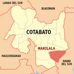
| Lage von Makilala in der Provinz Cotabato | |||
|---|---|---|---|
 | |||
| Basisdaten | |||
| Region: | SOCCSKSARGEN | ||
| Provinz: | Cotabato | ||
| Barangays: | 38 | ||
| Distrikt: | 2. Distrikt von Cotabato | ||
| PSGC: | 124707000 | ||
| Einkommensklasse: | 1. Einkommensklasse | ||
| Haushalte: | 12.380 Zensus 1. Mai 2000 | ||
| Einwohnerzahl: | 83.851 Zensus 1. August 2015 | ||
| Koordinaten: | 6° 57′ N, 125° 6′ O | ||
| Postleitzahl: | 9401 | ||
| Bürgermeister: | Onofre L. Repicio | ||
| Geographische Lage auf den Philippinen | |||
| |||

Baranggays
Makilala ist politisch in 38 Baranggays unterteilt.
|
|
|
This article is issued from Wikipedia. The text is licensed under Creative Commons - Attribution - Sharealike. The authors of the article are listed here. Additional terms may apply for the media files, click on images to show image meta data.