Liste der Naturschutzgebiete im Wartburgkreis
Im Thüringer Wartburgkreis gibt es 46 Naturschutzgebiete.
| Name des Gebietes | Bild | Kennung | WDPA | Landkreis / Stadt | Beschreibung / Bemerkungen | Standort | Fläche in Hektar | Datum der Verordnung |
|---|---|---|---|---|---|---|---|---|
| Alte Warth |  |
144 | 162101 | Wartburgkreis | Position | 86,1 | 1995 | |
| Alte Werra |  |
214 | 162103 | Wartburgkreis | Position | 257,8 | 1996 | |
| Arzberg |  |
090 | 14491 | Wartburgkreis | Position | 114,2 | 1961 | |
| Auewäldchen | 089 | 162268 | Wartburgkreis | Position | 28 | 1967 | ||
| Baier |  |
232 | 162330 | Wartburgkreis | Position | 63,4 | 1990 | |
| Bernshäuser Kutte | 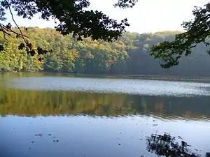 |
094 | 162394 | Wartburgkreis | Position | 13,6 | 1942 | |
| Brühl von Merkers | 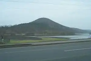 |
223 | 555588708 | Wartburgkreis | Position | 175,6 | 2014 | |
| Buchenberg | 229 | 162605 | Wartburgkreis | Position | 32,6 | 1990 | ||
| Dankmarshäuser Rhäden | 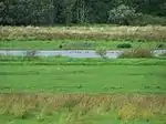 |
218 | 162702 | Wartburgkreis | Position | 121,7 | 1995 | |
| Dolinenhänge | 030 | 162772 | Wartburgkreis | Position | 65,4 | 1961 | ||
| Ebenauer Köpfe und Wisch | 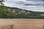 |
064 | 162830 | Wartburgkreis | Position | 79,7 | 1996 / 2017 | |
| Ebertsberge |  |
031 | 162836 | Wartburgkreis | Position | 35 | 1961 | |
| Erlensee - Maiwiesen |  |
226 | Wartburgkreis | Position | 108,9 | 2018 | ||
| Forstloch - Riedwiesen | 137 | 163134 | Landkreis Schmalkalden-Meiningen, Wartburgkreis | Position | 165,2 | 1982 | ||
| Großenbehringer Holz |  |
023 | 14484 | Wartburgkreis | Position | 117,9 | 1961 | |
| Hohe Klinge - Dorngehege |  |
098 | 163735 | Wartburgkreis | Position | 101,4 | 1961 | |
| Horbel - Hoflar - Birkenberg | 237 | 163792 | Landkreis Schmalkalden-Meiningen, Wartburgkreis | Position | 557,8 | 1990 | ||
| Horn mit Kahlköpfchen |  |
353 | 318573 | Landkreis Schmalkalden-Meiningen, Wartburgkreis | Position | 175,2 | 1999 | |
| Ibengarten |  |
093 | 9355 | Wartburgkreis | Position | 56,5 | 1938 | |
| Kalktuffniedermoor |  |
091 | 164003 | Wartburgkreis | Position | 5,6 | 1967 | |
| Karrenwiesen |  |
225 | 344591 | Wartburgkreis | Position | 37,2 | 2005 | |
| Klosterholz und Nordmannssteine | 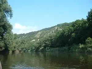 |
024 | 164150 | Wartburgkreis | Position | 139,1 | 1961 | |
| Kuhkopf | 238 | 164284 | Wartburgkreis | Position | 37,4 | 1990 | ||
| Lienig | 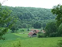 |
025 | 164451 | Wartburgkreis | Position | 22,5 | 1961 | |
| Mertelstal - Heldrastein | 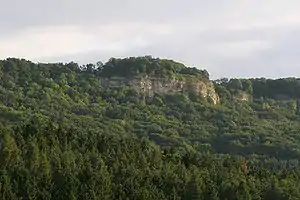 |
028 | 14485 | Wartburgkreis | Position | 252,5 | 1961 | |
| Muschelkalksteilhänge am Emberg | 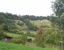 |
352 | 164739 | Wartburgkreis | Position | 18,1 | 1997 | |
| Öchsenberg |  |
227 | 318905 | Wartburgkreis | Position | 267,1 | 1990 | |
| Probsteizella |  |
027 | 165045 | Wartburgkreis | Position | 25,8 | 1961 | |
| Rasdorferberg | 231 | 165102 | Wartburgkreis | Position | 262,9 | 1990 | ||
| Rohrlache zwischen Dippach und Dankmarshausen | 221 | 378349 | Wartburgkreis | Position | 57,2 | 2007 | ||
| Rößberg | 234 | 165221 | Wartburgkreis | Position | 309,3 | 1990 | ||
| Roßberg-Kohlbach-Hochrain | 236 | 318677 | Wartburgkreis | Position | 667,9 | 1990 | ||
| Ruine Scharfenberg |  |
032 | 319023 | Wartburgkreis | Position | 10,3 | 1961 | |
| Sachsenburg | 092 | 165280 | Wartburgkreis | Position | 52,1 | 1961 | ||
| Schergesbachaue | 222 | 319061 | Wartburgkreis | Position | 34,3 | 1998 | ||
| Sommertal | 239 | 165596 | Wartburgkreis | Position | 253,1 | 1990 | ||
| Standorfsberg | 230 | 165642 | Wartburgkreis | Position | 27,9 | 1990 | ||
| Tannenberg - Seelesberg | 235 | 165828 | Wartburgkreis | Position | 263,8 | 1990 | ||
| Teufelsberg - Pietzelstein | 233 | 165860 | Wartburgkreis | Position | 198,4 | 1990 | ||
| Ulster |  |
228 | 165984 | Wartburgkreis | Position | 225,4 | 1990 | |
| Vordere Schwarzbachwiese | .jpg.webp) |
033 | 166099 | Landkreis Gotha, Wartburgkreis | Position | 8,7 | 1967 | |
| Wacholderheide bei Waldfisch |  |
143 | 166112 | Wartburgkreis | Position | 32,5 | 1995 | |
| Werraaue bei Berka und Untersuhl |  |
216 | 166255 | Wartburgkreis | Position | 255,8 | 1996 | |
| Werraaue mit Altarmen bei Unterrohn |  |
224 | 319315 | Wartburgkreis | Position | 88,6 | 2001 | |
| Werraaue Treffurt |  |
208 | 166254 | Wartburgkreis | Position | 68,5 | 1995 | |
| Wiesenthaler Schweiz |  |
145 | 166307 | Wartburgkreis | Position | 38,3 | 1990 | |
| Wilhelmsglücksbrunn |  |
210 | 319334 | Wartburgkreis | Position | 77,3 | 2000 |
Quellen
Weblinks
Commons: Naturschutzgebiete im Landkreis – Sammlung von Bildern, Videos und Audiodateien
Listen der Naturschutzgebiete in den Landkreisen und kreisfreien Städten in Thüringen
Landessymbol Thüringen
Naturschutzgebiete in den Landkreisen
Altenburger Land |
Eichsfeld |
Gotha |
Greiz |
Hildburghausen |
Ilm-Kreis |
Kyffhäuserkreis |
Nordhausen |
Saale-Holzland-Kreis |
Saale-Orla-Kreis |
Saalfeld-Rudolstadt |
Schmalkalden-Meiningen |
Sömmerda |
Sonneberg |
Unstrut-Hainich-Kreis |
Wartburgkreis |
Weimarer Land
Naturschutzgebiete in den kreisfreien Städten
Erfurt |
Gera |
Jena |
Suhl |
Weimar
This article is issued from Wikipedia. The text is licensed under Creative Commons - Attribution - Sharealike. The authors of the article are listed here. Additional terms may apply for the media files, click on images to show image meta data.