Lions Rump
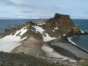
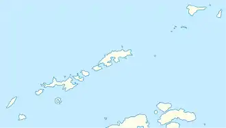
Lions Rump (englisch für Löwenkruppe; spanisch Cabo Anca de León) ist eine vorgebirgsartige Landspitze, welche die Westseite der Einfahrt zur King George Bay an der Südküste von King George Island in der Gruppe der Südlichen Shetlandinseln markiert.
| Lions Rump | ||
 Lions Rump, links der Mitte ragt der Tooth auf | ||
| Geographische Lage | ||
| ||
| Koordinaten | 62° 8′ S, 58° 7′ W | |
| Lage | King George Island (Südliche Shetlandinseln) | |
| Gewässer | King George Bay | |
| Gewässer 2 | Lions Cove | |
Kartiert und deskriptiv benannt wurde das Kap 1937 von Wissenschaftlern der britischen Discovery Investigations.
Weblinks
- Lions Rump im Geographic Names Information System des United States Geological Survey (englisch)
- Lions Rump auf geographic.org (englisch)
This article is issued from Wikipedia. The text is licensed under Creative Commons - Attribution - Sharealike. The authors of the article are listed here. Additional terms may apply for the media files, click on images to show image meta data.
