Laviscounts Island
Laviscounts Island ist eine Insel vor der Nordküste[1] der Karibikinsel Antigua des Staates Antigua und Barbuda.
| Laviscounts Island | ||
|---|---|---|
| Gewässer | Karibisches Meer (Atlantik)[1] | |
| Inselgruppe | Antigua (Kleine Antillen, Karibische Inseln) | |
| Geographische Lage | 17° 6′ N, 61° 43′ W | |
| ||
| Einwohner | unbewohnt | |
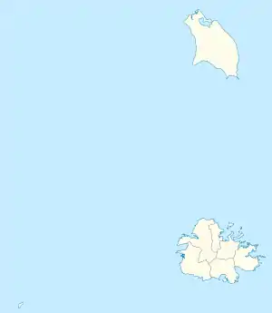
Lage und Landschaft
Laviscounts Island liegt, nur durch einen schmalen Kanal vom Festland getrennt, vor der Küste von Seatons in der Mercers Creek Bay, in einer Linie mit Crumps Point im Westen und Guard Point im Osten im Parish Saint Phillip.[2]
Einzelnachweise
- nach örtlichem Verständnis gilt die antiguanische Ostküste als „atlantisch“; die International Hydrographic Organization (IHO) definiert die Karibik–Atlantik-Küste entlang der 100-Faden-Linie (ca. 180 m), die einige Seemeilen vor Antigua liegt. International Hydrographic Organization: iho-ohi.net Limits of oceans and seas. Special publication, 23. Imp. Monégasque, Monte-Carlo 1953. Kap. 27. – Caribbean Sea, S. 14 f.
- Laviscounts Island bei GeoNames geonames.org. Abgerufen am 22. November 2021.
This article is issued from Wikipedia. The text is licensed under Creative Commons - Attribution - Sharealike. The authors of the article are listed here. Additional terms may apply for the media files, click on images to show image meta data.