Karimatainseln
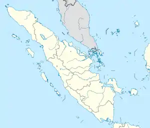
Die Karimatainseln (indonesisch Kepulauean Karimata) sind eine Inselgruppe unweit der Westküste des indonesischen Teils von Borneo und von Billiton durch die Karimata-Straße getrennt. Administrativ gehören sie zur Provinz Bangka-Belitung.
| Karimatainseln | ||
|---|---|---|
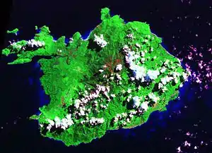
 Satellitenaufnahme von Karimata | ||
| Gewässer | Karimata-Straße | |
| Archipel | Große Sundainseln | |
| Geographische Lage | 1° 37′ S, 108° 53′ O | |
| ||
| Hauptinsel | Karimata | |
| Gesamte Landfläche | 222 km² | |
Die Gruppe besteht aus einer größeren (Karimata, 179 km²) und vielen kleineren Inseln mit zusammen 222 km² Fläche.
Auf der Insel Karimata erheben sich zwei Bergspitzen, der so genannte stumpfe und der scharfe Pik, mit 1022 und 1034 m Höhe.
This article is issued from Wikipedia. The text is licensed under Creative Commons - Attribution - Sharealike. The authors of the article are listed here. Additional terms may apply for the media files, click on images to show image meta data.
