Kap Russell
Das Kap Russell ist eine felsige Landspitze in der Terra Nova Bay an der Scott-Küste des ostantarktischen Viktorialands. Sie ist das südliche Ende der Föhnhalbinsel, die ihrerseits den südlichen Ausläufer der Northern Foothills bildet.
| Kap Russell | ||
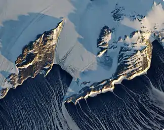 Kap Russel (Bildmitte unten), links: Inexpressible Island | ||
| Geographische Lage | ||
| ||
| Koordinaten | 74° 54′ S, 163° 55′ O | |
| Lage | Viktorialand, Ostantarktika | |
| Küste | Scott-Küste | |
| Gewässer | Terra Nova Bay | |
| Gewässer 2 | Evans Cove | |
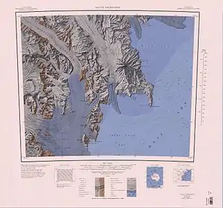 Topographische Karte der Northern Foothills (untere Kartenhälfte, links der Mitte) und Kap Russell | ||

Das Advisory Committee on Antarctic Names benannte das Kap 1968 nach Commander R. E. Russell von der United States Navy, verantwortlich für die Hubschrauberstaffel an Bord des Eisbrechers USS Glacier im Rahmen der Operation Deep Freeze in den Jahren 1958 bis 1959.
Weblinks
- Cape Russell im Geographic Names Information System des United States Geological Survey (englisch)
- Cape Russell auf geographic.org (englisch)
This article is issued from Wikipedia. The text is licensed under Creative Commons - Attribution - Sharealike. The authors of the article are listed here. Additional terms may apply for the media files, click on images to show image meta data.