Kap Lollo
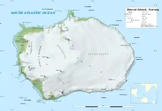
Kap Lollo (norwegisch Kapp Lollo) ist ein kleines Kap an der Ostküste der Bouvetinsel. Es befindet sich in gut 5 bis 6 km Entfernung von Kap Valdivia, dem nördlichsten Punkt der Insel, ist im Gegensatz zu diesem aber weniger charakteristisch ausgeprägt. Südlich davon erstreckt sich die Mowinckel-Küste, und nordwestlich die Victoria-Terrasse-Küste.
| Kap Lollo | ||
| Geographische Lage | ||
| ||
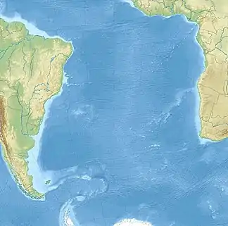
| Koordinaten | 54° 25′ S, 3° 26′ O | |
| Lage | Bouvetinsel | |
| Gewässer | Südatlantik | |
 Karte der Bouvetinsel mit Cape Lollo (rechts) | ||
Erstmals kartiert wurde der Landpunkt 1898 während der Valdivia-Expedition des Deutschen Carl Chun. Eine weitere Kartierung und die Benennung des Kaps erfolgte im Dezember 1928 bei einer norwegischen Expedition unter Harald Horntvedt (1879–1946).
Weblinks
- Artikel Kapp Lollo in The Place Names in Norwegian Polar Areas, Norsk Polarinstitutt, Oslo (englisch/norwegisch)
- Cape Lollo im Geographic Names Information System des United States Geological Survey
- Cape Lollo auf geographic.org (englisch)
This article is issued from Wikipedia. The text is licensed under Creative Commons - Attribution - Sharealike. The authors of the article are listed here. Additional terms may apply for the media files, click on images to show image meta data.
