Islas Coronado
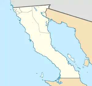
Die Islas Coronado bilden eine unbewohnte Inselgruppe vor der Küste des mexikanischen Bundesstaates Baja California, unweit der Stadt Tijuana.
| Islas Coronado | ||
|---|---|---|
 Blick von Coronado Sur auf die anderen Coronados | ||
| Gewässer | Pazifischer Ozean | |
| Geographische Lage | 32° 26′ N, 117° 16′ W | |
| ||
| Anzahl der Inseln | 4 | |
| Hauptinsel | Coronado Sur | |
| Gesamte Landfläche | 2,52 km² | |
| Einwohner | unbewohnt | |
 Topographische Karte | ||
Inseln
![]() Karte mit allen Koordinaten: OSM | WikiMap
Karte mit allen Koordinaten: OSM | WikiMap
| Insel | Fläche (ha) | Länge m | Breite m | Höhe m | Koordinaten |
|---|---|---|---|---|---|
| Coronado Norte | 48 | 1510 | 400 | 153 | 32° 26′ 23,0″ N, 117° 17′ 50,0″ W |
| Pilon de Azucar | 7 | 340 | 120 | 33 | 32° 25′ 28,0″ N, 117° 15′ 47,0″ W |
| Coronado Centro | 14 | 660 | 410 | 32 | 32° 25′ 02,0″ N, 117° 15′ 35,0″ W |
| Coronado Sur | 183 | 3580 | 610 | 220 | 32° 24′ 19,0″ N, 117° 14′ 43,0″ W |
| Islas Coronado | 252 | 220 |
Geschichte
Im September 1542 benannte Juan Rodríguez Cabrillo die Inseln Islas Desiertas (dt. „verlassene Inseln“). 1602 änderte Sebastián Vizcaíno den Namen der Insel um in Cuatro Coronados.
Flora und Fauna
Auf den Inseln Coronado Norte und Coronado Sur wachsen Dahlien, verschiedene Arten von Kakteen, Gurken und Hauswurz. Außerdem leben auf den Inseln kleine Kolonien von Seemöwen, Pelikanen und Enten. Auch einige seltene Reptilien und Amphibien sind hier beheimatet.
This article is issued from Wikipedia. The text is licensed under Creative Commons - Attribution - Sharealike. The authors of the article are listed here. Additional terms may apply for the media files, click on images to show image meta data.
