Greenwich Island
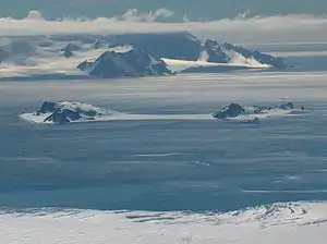
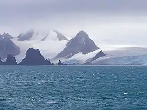
Greenwich Island (historische Namen: Sartorius Island, Berezina Island) ist eine Insel der Südlichen Shetlandinseln. Sie hat eine Länge von 24 km, eine Breite zwischen 0,8 und 10 km und weist eine Fläche von 173,8 km² auf.[1] Sie liegt in der Südgruppe des Archipels zwischen Robert Island im Nordosten und Livingston Island im Südwesten und wird von diesen getrennt durch die Englische und die McFarlane-Straße. Die höchste Erhebung der stark vergletscherten Insel ist der 625 m hohe Momchil Peak.
| Greenwich Island | ||
|---|---|---|
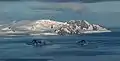
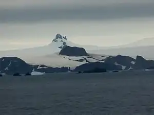
 Blick von Livingston Island auf Greenwich Island. Im Vordergrund Half Moon Island in der Moon Bay. | ||
| Gewässer | Südlicher Ozean | |
| Inselgruppe | Südliche Shetlandinseln | |
| Geographische Lage | 62° 31′ S, 59° 47′ W | |
| ||
| Länge | 24 km | |
| Breite | 10 km | |
| Fläche | 173,8 km² | |
| Höchste Erhebung | Momchil Peak 625 m | |
| Einwohner | 9 Stationspersonal im Winter <1 Einw./km² | |
| Hauptort | (Arturo-Prat-Station) | |
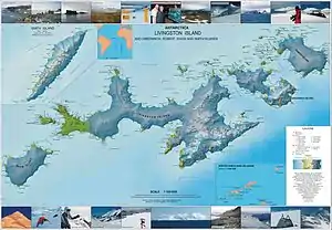
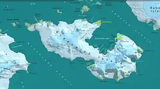 Karte von Greenwich Island | ||

Die chilenische Forschungsstation Arturo Prat und die ecuadorianische Station Pedro Vicente Maldonado liegen an der Discovery Bay im Nordosten der Insel.
Die Bezeichnung Greenwich Island datiert zurück auf das Jahr 1821 oder noch früher und hat sich als gängiger Name der Insel durchgesetzt.
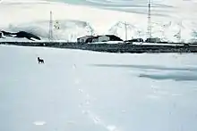 Arturo-Prat-Station
Karten
- L. L. Ivanov et al.: Antarctica: Livingston Island and Greenwich Island, South Shetland Islands (from English Strait to Morton Strait, with illustrations and ice-cover distribution). Topografische Karte im Maßstab 1:100.000, Antarctic Place-names Commission of Bulgaria, Sofia 2005.
- L. L. Ivanov: Antarctica: Livingston Island and Greenwich, Robert, Snow and Smith Islands. Topografische Karte im Maßstab 1:120.000. Manfred-Wörner-Stiftung, Troyan, 2009. ISBN 978-954-92032-6-4
Weblinks
Einzelnachweise
- UNEP Islands (englisch)