Flaherty Island
Flaherty Island ist die Hauptinsel der Belcher Islands im südöstlichen Teil der Hudson Bay. Sie gehört politisch zur Qikiqtaaluk-Region des kanadischen Territoriums Nunavut. Flaherty Island hat eine Fläche von 1585 km².[1]
| Flaherty Island | ||
|---|---|---|
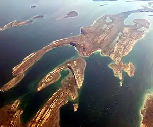
 Schrägluftbild von Flaherty Island | ||
| Gewässer | Hudson Bay | |
| Inselgruppe | Belcher Islands | |
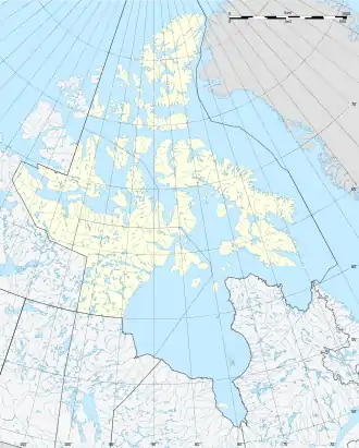
| Geographische Lage | 56° 14′ N, 79° 17′ W | |
| ||
| Länge | 108 km | |
| Breite | 38 km | |
| Fläche | 1 585 km² | |
| Höchste Erhebung | mehrere Erhebungen über 100 m | |
| Einwohner | 744 (2006) <1 Einw./km² | |
| Hauptort | Sanikiluaq | |
 Satellitenbild der Belcher Islands, Flaherty Island in der Bildmitte | ||
Die Insel erreicht im Nordosten an mehreren Stellen Höhen von mehr als 100 Metern.[2] Die kleine Inuit-Gemeinde von Sanikiluaq liegt an der Nordküste von Flaherty Island und ist der südlichste Ort in Nunavut.
Flaherty Island ist zu Ehren des Anthropologen und Dokumentarfilmers Robert J. Flaherty benannt, der die Belcher-Inseln 1913 bis 1914 auf der Suche nach Eisenerz erforschte.[3]
Einzelnachweise
- The Atlas of Canada – Sea Islands. (Memento vom 6. Oktober 2012 im Internet Archive)
- The Atlas of Canada – Toporama. (Memento vom 6. Oktober 2014 im Internet Archive) (Maßstab 1:600.000)
- Robert J. Christopher, Frances Hubbard Flaherty, Robert Joseph Flaherty: Robert and Frances Flaherty. A Documentary Life, 1883–1922. McGill-Queen’s University Press, 2005, ISBN 0-7735-2876-8, S. 280 ff. (eingeschränkte Vorschau in der Google-Buchsuche).
This article is issued from Wikipedia. The text is licensed under Creative Commons - Attribution - Sharealike. The authors of the article are listed here. Additional terms may apply for the media files, click on images to show image meta data.
