Easter Group
Die Easter Group, wörtliche deutsche Übersetzung Ostergruppe, ist eine kleine Inselgruppe im Indischen Ozean, gelegen etwa 60 km vor der westaustralischen Küste. Sie bildet die mittlere der drei atollähnlichen, in einer nord-südlichen Linie angeordneten Inselgruppen im Houtman-Abrolhos-Archipel.
| Easter Group | ||
|---|---|---|
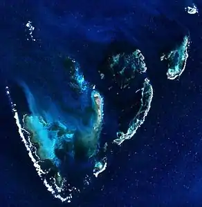 Satellitenbild der Inselgruppe | ||
| Gewässer | Indischer Ozean | |
| Archipel | Houtman-Abrolhos-Archipel | |
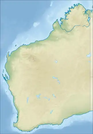
| Geographische Lage | 28° 44′ S, 113° 46′ O | |
| ||
| Anzahl der Inseln | 54 (28 offiziell benannt) (26 namenlos) | |
| Hauptinsel | Rat Island | |
| Gesamte Landfläche | 2,2 km² | |
| Einwohner | unbewohnt | |
Geographie
Die Inseln liegen auf einer Riffplattform, die rund 22 km lang und bis zu 18 km breit ist. Die Inselgruppe Easter Group liegt 12 km südlich des Evening Reef der Wallabi-Inseln und ist von diesen durch den Middle Channel getrennt. Sie liegt 10 km nordwestlich der Pelsaert-Inseln, getrennt durch den Zeewijk Channel.
Die Hauptinsel Rat Island ist mit Abstand die größte Insel der Gruppe sowie die fünftgrößte des gesamten Houtman-Abrolhos-Archipels. Sie ist 1,6 km lang und im Norden knapp 600 Meter breit. Ihre Flächenausdehnung beträgt 65,3 Hektar. Sie liegt im Zentrum der Lagune und ist über die Good Friday Bay („Karfreitagsbucht“) im Norden zu erreichen. Die Good Friday Bay bietet einen sicheren Ankerplatz. An der Nordostseite befindet sich ein Anlegesteg.[1]
Inseln
Zur Easter Group gehören 28 offiziell namentlich benannte Inseln[2] sowie 26 nur inoffiziell benannte kleine Inseln und Felsformationen wie z. B. „Campbell Islet“, die jeweils nur einige hundert Quadratmeter Fläche aufweisen.[3]
Eine Untergruppe der Easter Group sind die Eastern Islands (östliche Inseln).[4] Diese bilden ein separates kleines atollartiges Gebilde, das vom Rest der Easter Group durch die 1,7 km breite Eastern Passage getrennt ist.
![]() Karte mit allen Koordinaten: OSM | WikiMap
Karte mit allen Koordinaten: OSM | WikiMap
Nutzung
Alle Inseln sind mangels Trinkwasserquellen unbewohnt. Sie dürfen zum Schutz der Fauna und Flora nur mit besonderer Genehmigung betreten werden.
Einzelnachweise
- Sailing Directions (enroute), Pub. 175: North, West and South Coasts of Australia, 5.24 Easter Group (PDF-Datei; 3,55 MB)
- Gazetteer of Australia
- Inventory of the Land Conservation Values of the Houtman Abrolhos (PDF; 2,7 MB) Hier sind weitere offiziell unbenannte Inseln mit Bezeichnungen versehen
- Archivlink (Memento des Originals vom 24. September 2015 im Internet Archive) Info: Der Archivlink wurde automatisch eingesetzt und noch nicht geprüft. Bitte prüfe Original- und Archivlink gemäß Anleitung und entferne dann diesen Hinweis.
Weblinks
- NASA-Bild (Memento vom 23. Dezember 2010 im Internet Archive)
- Oceandots.com (weitere Infos & Bilder) (Memento vom 23. Dezember 2010 im Internet Archive) (engl.)